 Sinh Giang
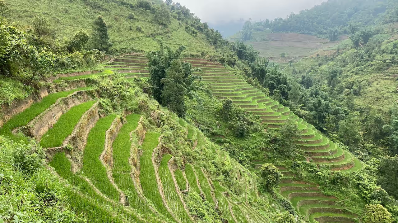
The best trek in Vietnam depends on the month more than on the place. From December to February the north is dry and cold, which suits the cloud ridge of Ta Xua, the Tay Con Linh and Ky Quan San peaks and, far to the south, the Ta Nang to Phan Dung trail. From March to May the Sapa valley paths, Pu Luong and Bach Ma are at their best. Late May and early June flood the terraces of Mu Cang Chai, and September and October turn Mu Cang Chai, Pu Luong and Sapa gold. This guide gives nine treks, the months the sources support for each, and an honest note on where Sapa wins and where it does not.
We are a Sapa trekking company and we run treks only in Sapa. That is a bias, so we handle it in the open: every trek below says where its figures come from, we say where sources disagree, and we tell you when another region is the better choice. We checked the facts on 19 November 2026. The site had no page on this question: our terrace decision page compares three rice-terrace areas and our best month guide covers the whole country, while this page is about walking, month by month.
Key Takeaways
- The north has its dry, cold window from about October to April: Ta Xua, Tay Con Linh and Ky Quan San sit in it, and so does the start-of-year dry season on the Ta Nang to Phan Dung trail in the south.
- Terraces peak twice: flooded in late May and early June, golden in September and October (Mu Cang Chai, Pu Luong, Sapa). Sapa is also pleasant in March to May.
- Central Vietnam does the opposite of the north: a guide to Bach Ma warns of heavy rain and leeches from October to December.
- The hardest of the nine are Ky Quan San, Ta Xua and Fansipan; the easiest is a 10 to 14 km Sapa valley walk or a half-day at Bach Ma.
- Sources disagree on heights, distances and seasons, so we give ranges and name the source instead of one tidy number.
Which Trek in Which Month
Match the trek to the month and the choice narrows to two or three. The strip is our reading of the sources for each trek: dark blue is the best window they give, amber is possible with a caveat, grey is outside the window. It is not a forecast, and clouds and rain do not follow a calendar.
Best window in the sourcesPossible, with a caveatOutside the window
Read the strip by column. In December it points north to the cloud ridges and south to Ta Nang. In May it points to Mu Cang Chai, Pu Luong and Bach Ma. In October most of the northern treks are dark blue at once, so the choice is about difficulty and distance from Hanoi, not about timing.
How We Checked
We read Wikipedia for each place, park and tour-operator pages for routes, and our own guides for Sapa. Three things shaped the text. Numbers differ between pages: Tay Con Linh is given as 2,419 m, 2,427 m and 2,428 m, Fansipan as 3,143 m or 3,147 m (Wikipedia says the 1909 figure of 3,143 m was later adjusted to 3,147.3 m), and the Ta Nang to Phan Dung trail as 50 to 55 km. Seasons differ too: for Pu Luong we found September to November, February to May and October to April. And operators sell trips, so where only an operator gave a figure we say so. We run treks only in Sapa, so for the other eight you are reading a desk review, and a local guide there will know the trail better than this page.
Month by Month: Four Windows
Vietnam has three climates, so the answer changes by region: a north with four seasons, a centre and south with a rainy and a dry season, and cool mountain pockets such as Sapa and Dalat (Wikipedia, climate of Vietnam). Our Vietnam weather guide has the national picture; here is what it means for walking.
December to February: the dry north and the dry south
The north is dry and cold in winter. Our Sapa weather guide gives 9 to 17°C in town, with mist, frost and rare snow on Fansipan. This is the window the sources give for Ta Xua cloud hunting (November to March), for Tay Con Linh (October to April, with December to February the driest in one guide) and for Ky Quan San (October to March). It is also the start-of-year dry season on the Ta Nang to Phan Dung trail. Sapa valley walks still work but trade views for mist, and the Mu Cang Chai terraces are bare.
March to May: spring and the first water
Sapa's spring is mild, 14 to 23°C in March and April, with the first heavy rain in May. It suits the Lao Chai to Ta Van walk, Bach Ma (one guide says March to August, with rhododendrons at the Do Quyen waterfall in March and April) and Pu Luong, where one source puts the best time at February to May. Late April and early May are planting time at Mu Cang Chai; the water arrives in late May.
June to August: wet north, dry centre
The north is hot and wet, and Sapa's heaviest rain falls in July and August on muddy trails. Two things still work: the flooded terraces of Mu Cang Chai and the green fields of Pu Luong in early June, and Bach Ma on the central coast, whose guide lists its good months through August. Fansipan and the cloud-ridge treks are a poor use of these months.
September to November: harvest in the north, rain in the centre
Mu Cang Chai's golden season is September to October (the national tourism portal; one guide says mid-September to mid-October), and Pu Luong and Sapa ripen at the same time. Our Sapa guide calls September to November the peak. Central Vietnam does the opposite: the Bach Ma guide warns of heavy rain and leeches from October to December. From late October the northern cloud treks begin.
Sapa: the Valley Walk and Fansipan
Sapa is the easiest of the nine to reach and the only one where you choose your own difficulty, from a flat walk for seniors to a summit with a night in camp. It offers two treks for this comparison, and they are very different.
Lao Chai to Ta Van valley walk
Distance: 10 to 14 km (6 to 9 miles), 4 to 6 hours of walking.
Route: Y Linh Ho, Lao Chai and Ta Van along the Muong Hoa stream.
Best months: March to May and September to November.
Rules: we found no permit for valley walks; confirm with your operator.
Fansipan, the Roof of Indochina
Height: 3,143 m in our guide, 3,147 m in some sources.
Route: Tram Ton trailhead (about 1,900 m) to a camp near 2,800 m, summit on day two.
Best months: March to May and September to November.
Rules: register and use a licensed guide (our permit guide).
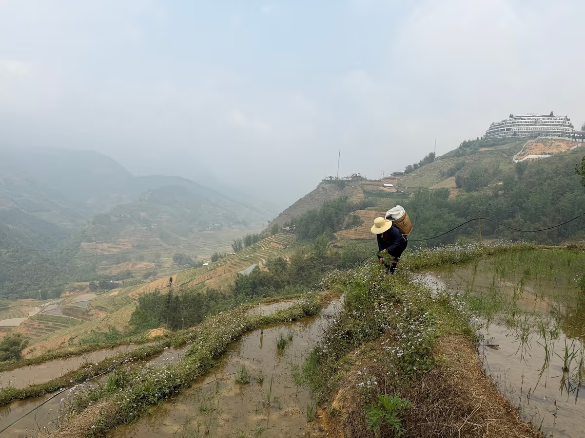
The valley walk packs terraces, two ethnic-minority villages and a home-cooked lunch into one moderate day; our Lao Chai to Ta Van guide has the route. Fansipan is the shortest way in this list to a 3,000 m summit, and our Fansipan guide says plainly that if you do not hike regularly the cable car is the wiser choice. Wikipedia notes that the climb once took five or six days and now takes one to three. Sapa's weak points are real: a cold, misty winter, and July and August as its wettest months.
Two Sapa Treks From This Guide


Mu Cang Chai and Pu Luong
If terraces are the reason you want to walk, Mu Cang Chai and Pu Luong are the two serious rivals to Sapa, and our terrace decision page compares them with Mai Chau in more detail.
Mu Cang Chai has about 2,200 hectares of terraces in three communes, La Pan Tan, Che Cu Nha and De Xu Phinh, and a national heritage listing since 2007 (Wikipedia). Wikipedia now lists it as a former district of Lao Cai province, the same province as Sapa. It is the farthest from Hanoi, about 300 km and 5 to 8 hours by road, and Sapa to Mu Cang Chai is about 195 km and 6.5 to 8.5 hours (our terrace page, 2026 guide). The walks are mostly village to village on terrace paths, and much of the view comes from the Khau Pha Pass road. It beats Sapa in the water weeks and in sheer scale of one hillside; it loses on the day you spend in transit each way.
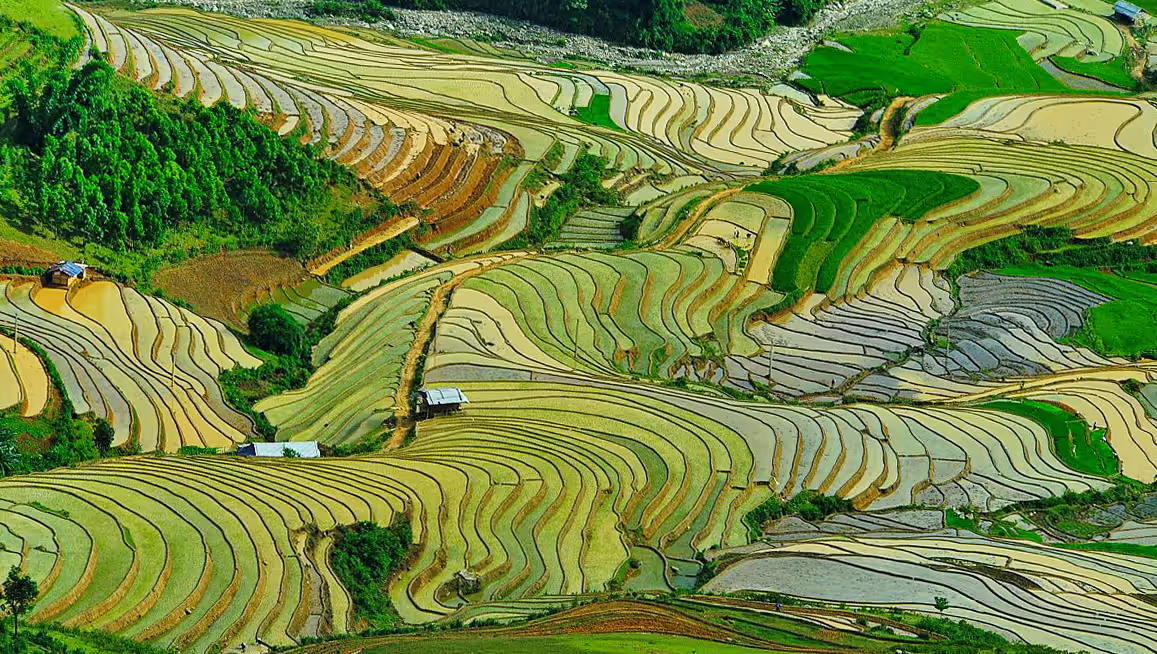
Pu Luong is a nature reserve in Thanh Hoa province, 17,662 hectares, about 4.5 hours from Hanoi (our terrace page). Operators sell one- to three-day itineraries, including a trek they call hard, about 10 km, to Hieu waterfall, and a walk to Kho Muong whose length is given as 6 km, about 10 km or a 4 to 5 hour hike depending on the page. It beats Sapa as a two- or three-day escape from Hanoi in the green and golden weeks. It loses on range: Sapa offers a flat day, a 3,000 m summit and everything between, and Pu Luong does not.
Ta Xua, Tay Con Linh and Ky Quan San
These three are the winter peaks, the treks that Sapa cannot match between November and March, and none is a first trek. All three are mostly sold as overnight trips with basic huts or camps.
Ta Xua is in Bac Yen district, Son La province, roughly 230 to 250 km from Hanoi; the summit is given as 2,865 m. It is usually a two-day, one-night or three-day, two-night trek with night stops in basic huts, and the narrow Dinosaur Spine ridge is its signature. Sources put cloud-hunting season at November to March, one at October to April, and all warn that clouds are never guaranteed. Operator pages rate the trek hard. Check the location when you book: another “dinosaur spine” sits in Lang Son province.
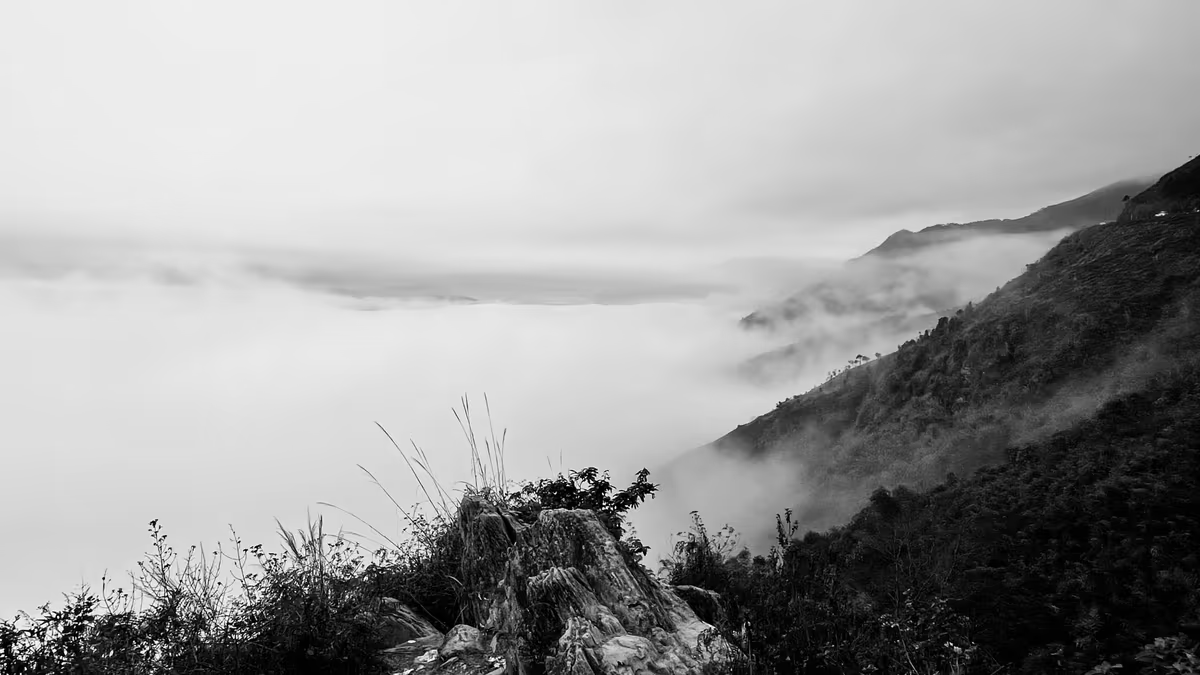
Tay Con Linh is in the north of the Ha Giang area; the summit is 2,419 m to 2,428 m depending on the page. One operator lists a two-day, one-night trek with 7 to 8 hours of walking a day (12 to 16 km); other guides describe three or four days. Ratings range from 4 out of 10 (Summits.com) to a physically demanding multi-day expedition. The dry season is roughly October to April, and the slopes are slippery in rain. Our Ha Giang Loop guide and Sapa vs Ha Giang page are about the motorbike loop, a different trip.
Ky Quan San, also called Bach Moc Luong Tu, is about 3,046 m in Bat Xat, Lao Cai, with the trailhead village about 60 km north of Lao Cai city. Three days and two nights is the usual plan; one operator rates the difficulty 4 out of 5, and a blogger describes using his hands on the steep slopes. Sources give October to March for the season, and one says late August to April. The area is near the border, so read our permit guide and ask your operator to confirm in writing what applies.
In our view, for cold-season cloud views and a summit away from a cable car, these three beat Sapa.
The South and the Centre
Ta Nang to Phan Dung is the long one. Wikipedia describes a multi-day trail from Ta Nang in Duc Trong, Lam Dong province, to Phan Dung in Tuy Phong, Binh Thuan province, of 50 to 55 km (up to 60 km with side trips), falling from about 1,100 m to 500 m, usually in two or three days, with navigation and rainy-season risks. After incidents in 2017 and 2018, entry registration, signs, an emergency hotline and trailhead controls were added, and trained local guiding is recommended. Vietnam Tourism lists it among dry-season treks for the start of the year; other pages give other months, so ask at registration.
Bach Ma is near Hue and Da Nang; its peak is 1,450 m, and Wikipedia calls it one of the wettest places in Vietnam. A guide on vietnamtourism.com says March to August is the best season, entry is 60,000 VND (other pages give 40,000 to 65,000 VND), the Five Lakes trail is about 2 km and the Do Quyen waterfall trail a steep 1.5 km. Half a day to a full day is enough. Rain and leeches arrive from October to December. Also worth a look: Cuc Phuong in Ninh Binh has its dry season from November to February (Wikipedia), and Oxalis lists multi-day Tu Lan cave treks in Phong Nha from mid-November to mid-September; we did not research either deeply enough to rank it.
Nine Treks Side by Side
The table puts the numbers together; the tiers below it are our ordering by effort, drawn from the same sources, not a measurement.
| Trek | Where | Usual length | Best window |
|---|---|---|---|
| Lao Chai to Ta Van | Sapa, Lao Cai | 10–14 km, 4–6 hours | Mar–May, Sep–Nov |
| Fansipan | Sapa, Lao Cai | 1–3 days, camp near 2,800 m | Mar–May, Sep–Nov |
| Mu Cang Chai | Northwest | Village walks, 2–3 days there | Late May–Jun, Sep–Oct |
| Pu Luong | Thanh Hoa | 1–3 days, Hieu waterfall about 10 km | Late May–Jun, Sep–Oct |
| Ta Xua | Son La | 2–3 days, huts | Nov–Mar |
| Tay Con Linh | Ha Giang area | 2–4 days | Oct–Apr |
| Ky Quan San | Bat Xat, Lao Cai | 3 days, 2 nights | Oct–Mar |
| Ta Nang to Phan Dung | Lam Dong to Binh Thuan | 50–55 km, 2–3 days | Start of the year |
| Bach Ma | Near Hue and Da Nang | Half a day to a day | Mar–Aug |
Half a day to one day
- Bach Ma
- Lao Chai to Ta Van
- Pu Luong, one-day walks
Long or steep, with a night out
- Mu Cang Chai, multi-day walks
- Fansipan
- Tay Con Linh
Basic huts, long days
- Ta Xua
- Ky Quan San
- Ta Nang to Phan Dung
When Sapa Is the Right Pick
Sapa is the right pick when you want the widest choice with the least friction, and the wrong one when the month or the mood points elsewhere. Here is the short version.
Choose Sapa when
It is your first trek, or the group has mixed fitness: there is a flat day for seniors and a summit for the fit.
You have two or three days and want a homestay in a village on the valley floor.
You are travelling in March to May or September to November.
Choose elsewhere when
It is December to February and you want clear cloud views: Ta Xua or Tay Con Linh.
You are in the south from January to March: Ta Nang to Phan Dung. On the central coast from March to August: Bach Ma.
You want the flooded terraces of late May: Mu Cang Chai.
A rule of thumb we use with travellers: pick the month first, then the region, then the difficulty. A March trip points to Sapa or Bach Ma, a May trip to the flooded terraces, an October trip to almost anywhere in the north, and a January trip to the cloud ridges or the south. If your dates are fixed and nothing here matches, tell us the dates. We will say honestly whether Sapa is worth it then, and which of the other eight to ask a local operator about.
Three Ways to Walk the Muong Hoa Valley
 1-Day Trek
Trekking Through Rice Terraced Fields
The Muong Hoa Valley floor through Black H’mong and Red Dao villages.
 Homestay
Sapa Valley Trek and Homestay
The full length of the Muong Hoa Valley over three days.
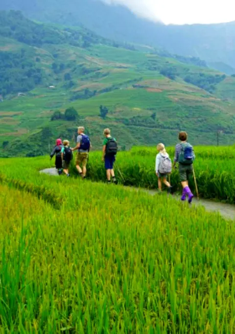 Seniors & Families
Sapa Easy Trekking For Seniors
Gentle paths with no steep sections, for 60+ travellers and families.
Guides, Permits and Getting There
Rules differ by trek. On Fansipan you must register and use a licensed guide, and for the Sapa valley walks we found no permit, though we could not open an official text, so confirm with your operator (our permit guide has the detail). On Ta Nang to Phan Dung, Wikipedia recommends trained local guiding and notes entry registration. In the border area around Y Ty, near Ky Quan San, a permit rule for foreigners applies and practice is reported as inconsistent. For every trek in this guide, ask the operator in writing what applies to your dates. Keep a spare day in the plan, because trails and roads can close in heavy rain: the Bach Ma guide, for instance, warns that the park closes its summit road without notice after heavy rain.
For gear and fitness, what to pack, how hard Sapa trekking is and the cost guide are the places to start. For Sapa itself, the transport block below shows how to get there.
The Part We Can Book for You
- Hanoi to Sapa transport — sleeper buses, limousines and the overnight train, bookable with your trek
- Hanoi to Sapa guide — what each option costs and how long it takes
- How to get to Sapa — the first leg, in detail
Rent at Our Office Before You Trek
 Gear Rental
Trekking Boots Rental
Waterproof ankle-support boots. Cleaned and checked before each rental. Available at 105 Thach Son Street.
 Gear Rental
Walking Poles Rental
Trekking poles available to rent at $2/day at our office, 105 Thach Son Street. Essential for descents.
Frequently Asked Questions
It depends on the month. In the north the dry window runs from about October to April, which suits Ta Xua, Tay Con Linh and Ky Quan San, while Sapa and Mu Cang Chai are best in March to May and September to October. For a first trek with the widest choice of difficulty, we would pick Sapa.
September to November and March to May are the best months for Sapa, according to our weather guide. Mu Cang Chai peaks in late May to early June, when the terraces are flooded, and in September to October, when the rice is golden. December to February is dry and cold, best for cloud treks such as Ta Xua.
Yes. The north is dry but cold, with Sapa at about 9 to 17 degrees C in town, and the sources give November to March for Ta Xua cloud hunting. The Ta Nang to Phan Dung trail in the south is listed among dry-season treks for the start of the year. Mu Cang Chai terraces are bare then.
Of the nine here, Ky Quan San (one operator rates it 4 out of 5), Ta Xua and Fansipan involve the steepest ground and nights in huts or camps, and Ta Nang to Phan Dung is the longest at 50 to 55 km. This is our reading of the sources, not a measurement.
On Fansipan you must register and use a licensed guide. For Sapa valley walks we found no permit, but confirm with your operator. Wikipedia recommends trained local guiding on Ta Nang to Phan Dung, and a border-area permit rule can apply near Ky Quan San, so ask in writing.
Sapa is the best starting point for most people, because it offers everything from a flat day walk to a 3,000 m summit and is easy to reach. It is not the best in December to February, when Ta Xua or Tay Con Linh give clearer cloud views, or in the south and centre in their dry months.
The Lao Chai to Ta Van valley walk in Sapa is a moderate 10 to 14 km day, and our seniors tour is gentler still. At Bach Ma, one guide describes the Five Lakes trail as about 2 km and says half a day is enough. Both are far easier than Fansipan or Ta Xua.
Late May to early June, when the terraces are flooded, and September to October, when the rice is golden. The national tourism portal gives those windows for Mu Cang Chai and Pu Luong, and our Sapa guide gives the same for the Muong Hoa Valley. Late April to early May is planting, so fields can look bare.