The Ha Giang Loop is the greatest road trip in Vietnam, and one of the best in the world. It's a roughly 350-kilometre circuit through the country's wildest northern province, climbing over knife-edge mountain passes, dropping into limestone canyons, and winding past ethnic-minority villages where life has barely changed in a century. For a growing wave of travelers, it's the highlight of the whole country — raw, remote, and genuinely unforgettable.
A decade ago, Ha Giang was a forgotten frontier that few foreigners reached. Today it is the fastest-rising destination in Vietnam, drawing riders from around the world — and yet, because the terrain keeps mass tourism out, it still feels genuinely wild once you are on the road. You share the passes with H'mong farmers driving buffalo, children walking to school, and trucks grinding up the grades, not tour coaches.
It's also demanding. The loop means several days on twisting mountain roads, by motorbike or in a car, in conditions that change with the weather and the altitude. This guide is the complete, honest version: the route and map, how many days you need, a day-by-day itinerary, the unmissable stops, the all-important decision of riding yourself versus hiring an "easy rider", and a straight answer on safety — because the loop is spectacular, but it deserves respect.
And we'll be honest about one more thing, because we're a local trekking company and we'd rather you have the right trip than the most extreme one: the Ha Giang Loop isn't for everyone. If you want the mountains of the north without days in the saddle, there's a gentler path. More on that near the end. First, the loop itself.
The Loop at a Glance
Here's the Ha Giang Loop in four numbers — the quick orientation before you start planning.
The Route & Map
The loop starts and ends in Ha Giang City and runs clockwise (most riders' choice) through the four districts of the Dong Van Karst Plateau Geopark: Quan Ba, Yen Minh, Dong Van and Meo Vac. The classic version then closes the circle via Du Gia. The map below shows the shape of it — a rough triangle of mountain road pinned to the Chinese border.
How Many Days Do You Need?
Three to four days is the sweet spot for the Ha Giang Loop. You can rush it in two, but you'll spend all day on the bike and miss the point — the loop is about stopping, not just riding. Here's how the options break down:
- 3 days / 2 nights — the popular minimum. Ha Giang → Yen Minh/Dong Van → Meo Vac → back. Covers all the headline scenery but moves quickly, with long riding days.
- 4 days / 3 nights — the sweet spot. The same route with breathing room: time for the Lung Cu flag tower, a Nho Que river boat trip, a market morning, and the quiet Du Gia return leg.
- 5+ days — for those who want to slow right down, add side trips, hike between villages, or wait out bad weather. The plateau rewards every extra day you give it.
Don't underestimate the riding. These are mountain roads — average speeds are low, fog and rain are common, and you'll want to stop constantly for photos. Plan for shorter daily distances than the kilometres suggest.
To put the pace in perspective: a stretch that looks like an hour on the map can take two or three once you factor in the switchbacks, the photo stops you will not be able to resist, and the inevitable fog or a herd of goats in the road. Most riders cover 70–140 km a day on the loop — modest distances that still fill the daylight. Build in a buffer, and never plan to ride after dark.
The Classic 4-Day Itinerary
This is the route most travelers ride, clockwise from Ha Giang City. Treat it as a frame, not a timetable — the joy is in the unplanned stops.
Tip: if your time is tight, ride the loop anticlockwise and end at Ma Pi Leng for a grand finale — though most riders prefer clockwise so the best scenery builds toward the middle.
Where you sleep matters as much as where you ride. Yen Minh and Dong Van both have a good spread of homestays and small hotels, while Du Gia on the return leg is beloved for its laid-back village homestays with communal dinners. Booking a night or two ahead in peak season (September–November) is wise; the rest of the year you can usually find a bed on arrival.
The Unmissable Stops
The loop is one long highlight reel, but four places stand above the rest. These are the ones to slow down for.
1. Quan Ba Twin Mountains & Heaven's Gate
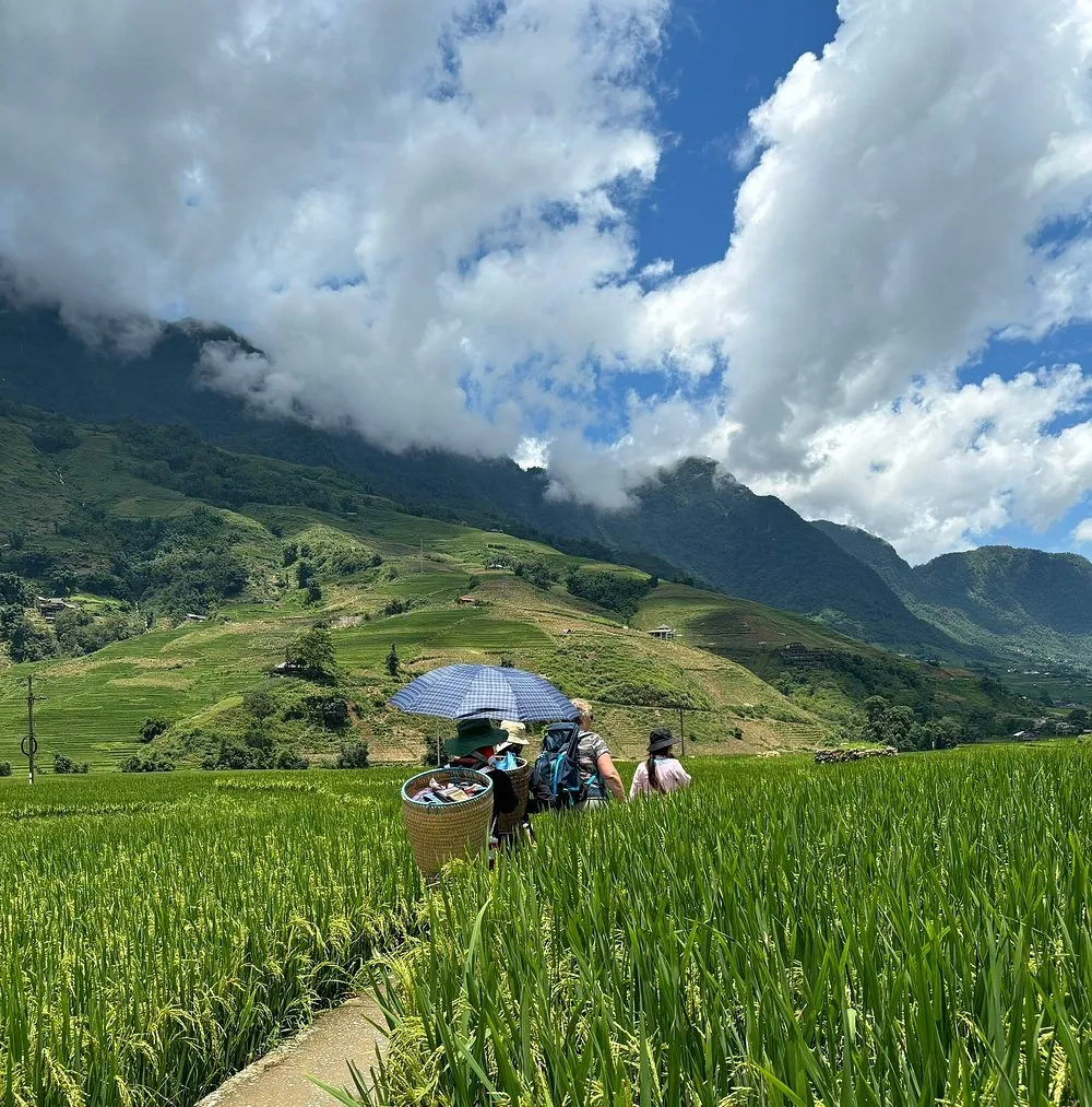
Your first taste of the plateau comes barely an hour from Ha Giang City. The Quan Ba Pass — "Heaven's Gate" (Cong Troi) — opens onto a viewpoint over the Tam Son valley and the famous Twin Mountains (Nui Doi): two perfectly symmetrical green hills rising from a chequerboard of rice fields. It's the moment the scale of what's ahead first hits you.
It is worth pausing properly here rather than just snapping a photo. The viewpoint has a small café, and the short walk gives you the first real sense of the geology you will be riding through for days — the bizarre, beautiful karst that earned the whole plateau its UNESCO Geopark status. From Quan Ba, the road begins to climb in earnest.
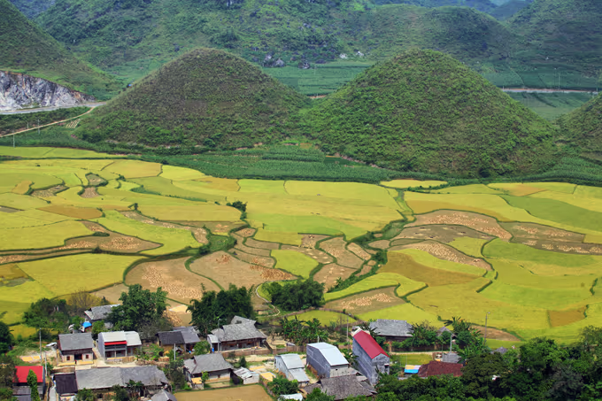
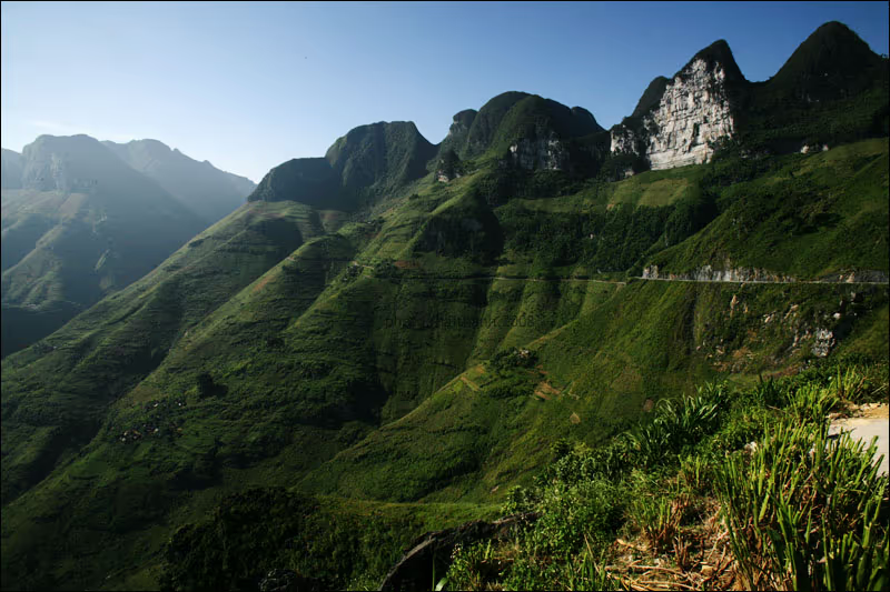
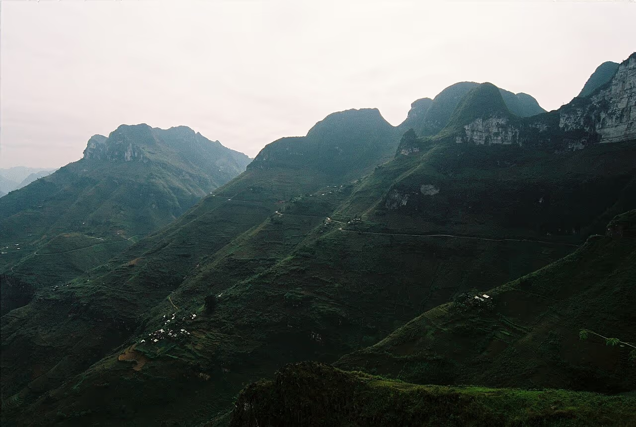
2. The Dong Van Karst Plateau
The heart of the loop is the Dong Van Karst Plateau Geopark, a UNESCO Global Geopark of grey limestone peaks, deep valleys and stone-walled H'mong villages clinging to impossibly steep slopes. The riding here is sublime — ribbons of road carved into the mountainsides — and the old quarter of Dong Van town, with its century-old clay-and-stone houses, is the best place to rest for a night. Don't miss the Lung Cu flag tower nearby, marking the northernmost point of Vietnam.
Dong Van itself rewards an evening. The old quarter, built by H'mong and Tay traders over a century ago, comes alive after dark with little cafés in the stone houses and, on weekends, a night market. It is also the launch point for the loop's grand finale — the Ma Pi Leng Pass — so most riders overnight here before tackling it fresh in the morning.
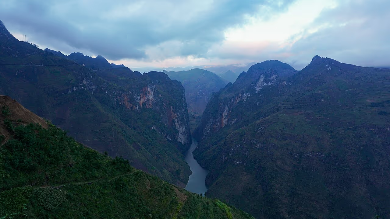
3. Ma Pi Leng Pass & the Nho Que River
If the loop has a single defining image, this is it. The Ma Pi Leng Pass — the road between Dong Van and Meo Vac — clings to a cliff face nearly two thousand metres up, with the emerald Nho Que River threading through the Tu San canyon far below, the deepest gorge in Southeast Asia. It is, without exaggeration, one of the most spectacular stretches of road on Earth. Stop at the viewpoints, walk a section of the "Skywalk" path if you dare, and take a boat trip on the river below for the view back up.
A word on the Nho Que boat trip: it has become one of the loop's must-dos, and rightly so. You ride or drive down a steep switchback road to the river, then glide by small boat into the Tu San canyon, where the limestone walls rise almost vertically hundreds of metres on either side. Seeing the gorge from the water, after seeing it from the pass above, is the moment many riders rate the highlight of the whole trip. Allow a couple of hours for the detour.
Nothing quite prepares you for the first time the canyon opens up. You round a bend on the pass and the world simply falls away — a near-vertical kilometre of rock dropping to a thread of impossible green water, the road a thin scratch across the cliff ahead. Riders routinely just stop, pull off their helmets, and stare. It is the kind of view that recalibrates what you thought a road could be.
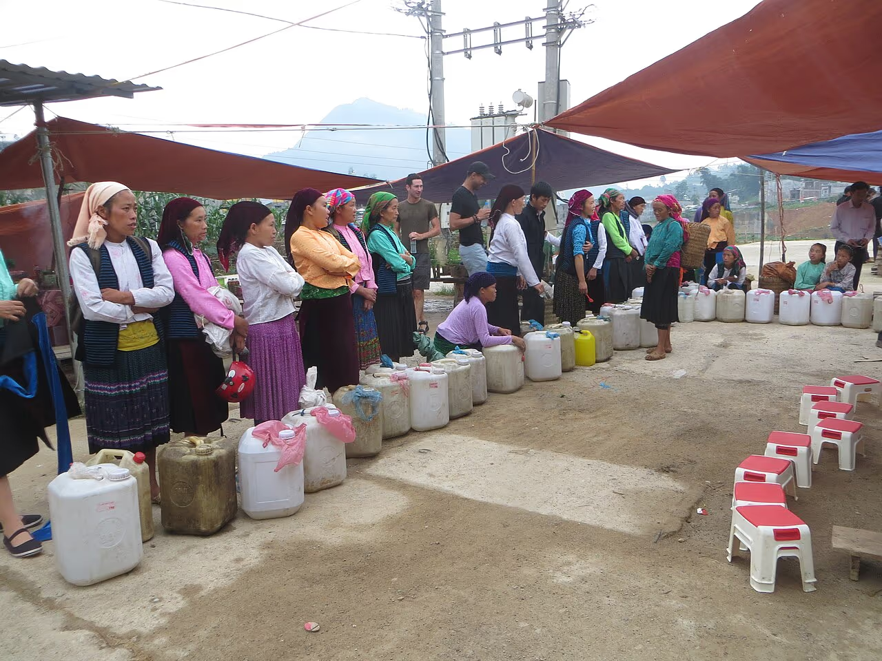
4. The Markets of the North
Time your loop around a market day and you'll see the plateau at its most alive. The Sunday markets at Dong Van and Meo Vac, and the rotating markets of smaller towns, draw H'mong, Tay, Lo Lo and Dao families from across the mountains in a riot of colour — trading livestock, textiles, corn wine and food, catching up, courting. It's not a show put on for tourists; it's the social heartbeat of the region, and a privilege to witness.
A few markets run on a rotating weekly schedule rather than every Sunday, so it pays to check the dates when you plan your route — landing in Meo Vac on market morning is worth reshuffling a day for. Go early, when the trading is liveliest and the light is soft, and remember you are a guest: buy a little, ask before you photograph people, and let the morning unfold at its own pace.
This corner of Vietnam is home to more than a dozen ethnic groups — H'mong, Tay, Dao, Lo Lo, Giay and others — each with its own dress, language and customs, often living in villages a single ridge apart. It is one of the most culturally rich regions in Southeast Asia, and the markets, festivals and roadside encounters are where that diversity comes alive. Travel with curiosity and respect, and the people prove as memorable as the passes.
Beyond the headline four, the loop is studded with smaller gems worth a pause: the dizzying Tham Ma Pass with its switchback viewpoint, the time-warp village of Pho Bang, the Lung Tam cooperative where H'mong women still weave and dye indigo linen by hand, and the Vuong Palace, the opium-era mansion of a former H'mong king. Leave room to stop on impulse — the unplanned detours are often the ones you remember most.
Self-Ride or Easy Rider?
This is the single biggest decision of your loop, and it shapes the whole experience. You either ride a motorbike yourself, or you sit on the back behind a local "easy rider" driver. Here's the honest trade-off.
🏍 Self-ride (you drive)
- Total freedom — stop where and when you want
- Cheaper (bike rental ~$10–15/day)
- The thrill of riding it yourself
- Best for confident, experienced riders
- ⚠️ Real risk if you're not experienced on mountain roads
🧑 Easy rider (local drives)
- You relax and soak up the views — no white knuckles
- A local who knows every bend, viewpoint and homestay
- By far the safer option (and legal without a licence issue)
- Insider access to villages, food and stories
- Costs more (~$50–70/day all-in), but worth it for most
Our honest advice: unless you're a genuinely experienced motorbike rider, take an easy rider or join a guided jeep/car tour. The roads are unforgiving, and "I learned to ride in Ha Giang" is how a lot of trips end badly. One more legal note: technically you need a Vietnam-valid licence to ride here, and riding without one can void your travel insurance — another reason many travelers choose to be driven.
If you do ride yourself, rent from a reputable shop in Ha Giang City (not the cheapest one), insist on a semi-automatic or manual bike you have actually ridden before, check the brakes and tyres, and save the shop's phone number for breakdowns. Automatic scooters struggle on the steep grades and are best avoided. And whatever you ride, wear a proper helmet — not the flimsy plastic shell that often comes free with the bike.
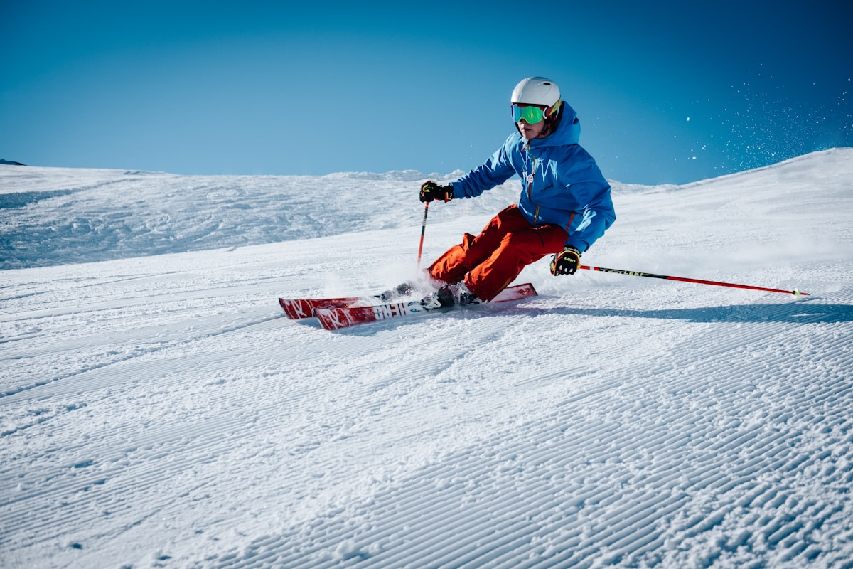
The riding itself, if you are up to it, is sublime: long sweepers on the main passes, the engine note bouncing off the rock, cool mountain air, and a new postcard around every corner. But it demands constant attention — blind bends, oncoming trucks that use the whole road, gravel washed across the tarmac after rain, and livestock that appears from nowhere. It rewards calm, defensive riding and punishes bravado. Ride like you have nothing to prove.
Is the Ha Giang Loop Safe?
Yes — if you respect it. The Ha Giang Loop is safe for sensible travelers, and tens of thousands ride it every year without incident. But it would be dishonest to pretend there's no risk: these are steep, winding mountain roads with sheer drops, sudden fog, loose gravel, and the occasional truck, and there are serious motorbike accidents every year, almost all involving inexperienced self-riders.
The risk is almost entirely in your control. Ride within your limits (or don't ride — take an easy rider), go slowly, never ride at night or after drinking the ever-present corn wine, wear a proper helmet, and check the weather. Done sensibly, the loop is no more dangerous than any mountain road. Done recklessly, it's genuinely dangerous — so be the sensible one.
It is also worth being realistic about insurance and medical care. The plateau is remote, hospitals are basic and far apart, and a serious accident can mean a long, slow evacuation. Make sure your travel insurance explicitly covers motorbiking (many policies do not, especially without a valid licence), carry a small first-aid kit, and ride with at least one other person where you can. None of this should scare you off — it should just keep you sensible.
Best Time to Ride
The best time to ride the Ha Giang Loop is September to November, when the rains have eased, the skies are clearest, and the rice terraces around the plateau turn gold for the harvest. March to May is the next-best window — dry and warm, with the buckwheat and fruit blossoms of spring.
Summer (June to August) is the wet season: the landscape is at its greenest, but heavy rain brings fog, slippery roads and the real risk of landslides — the most dangerous time to ride. Winter (December to February) is dry but bitterly cold and often thick with fog on the high passes, with rare frost or snow. Whenever you go, the mountains are far colder than Hanoi, so pack proper layers, and always carry a rain poncho.
One special mention: if you can, time your visit for the buckwheat-flower season in late October and November, when the plateau's fields turn soft pink and the cool, clear air makes for the best riding of the year. It is the single most beautiful window on the loop, and worth planning a trip around.
How to Get to Ha Giang
Ha Giang City, where the loop begins, is about 280 km north of Hanoi — roughly six to seven hours by road. The standard way is an overnight or daytime sleeper bus or limousine van from Hanoi; there's no airport or train. Most riders arrive the evening before, sleep in Ha Giang City, and start the loop fresh in the morning.
The overnight sleeper buses are the cheapest option (around $12–17) and save a night's accommodation, though they are basic and the mountain road makes for a bumpy sleep. The newer limousine vans — reclining seats, fewer passengers — cost a little more and are far more comfortable for the daytime run. Either way, book a day or two ahead in high season, when seats fill fast.
If you're weighing Ha Giang against the more accessible mountains around Sapa — also reached from Hanoi, and a far gentler introduction to the north — we run comfortable door-to-door transfers on the Hanoi–Sapa route, so you arrive rested and ready to walk rather than ride.
Prefer the Gentler North? Get to Sapa Easily


What Does the Loop Cost?
Ha Giang is exceptional value. A self-ride budget trip can come in around $30–50 a day all-in: bike rental ($10–15), fuel ($5–10), homestays with dinner and breakfast ($8–15), plus food and the odd entrance fee on top. An easy-rider package — which bundles the driver, bike, fuel, accommodation and meals — typically runs $50–80 a day, the simplest and safest way to do it without hidden costs. Multi-day group or private car and jeep tours sit a little higher again but remove every logistical headache. Whichever way you go, the loop remains one of the most affordable world-class adventures anywhere on the planet.
For all that value, do not pick your operator on price alone. The cheapest bike shops and tours cut corners on bike maintenance, helmets and guide experience — exactly the things that matter most on roads like these. Read recent reviews, check what is actually included, and treat a slightly higher price as money well spent on safety.
Ha Giang or Sapa? An Honest Comparison
Here's the conversation we have with travelers most often. Ha Giang and Sapa are the two great mountain experiences of northern Vietnam, and they suit very different people. We run treks in Sapa, so we have skin in the game — but we'll give it to you straight, because the wrong choice ruins a trip.
Choose Ha Giang if you're after raw adventure, you're a confident motorbike rider (or happy on the back of one), you have 4+ spare days, and the journey itself — days on epic roads — is the point. It's wilder, more remote, and more demanding.
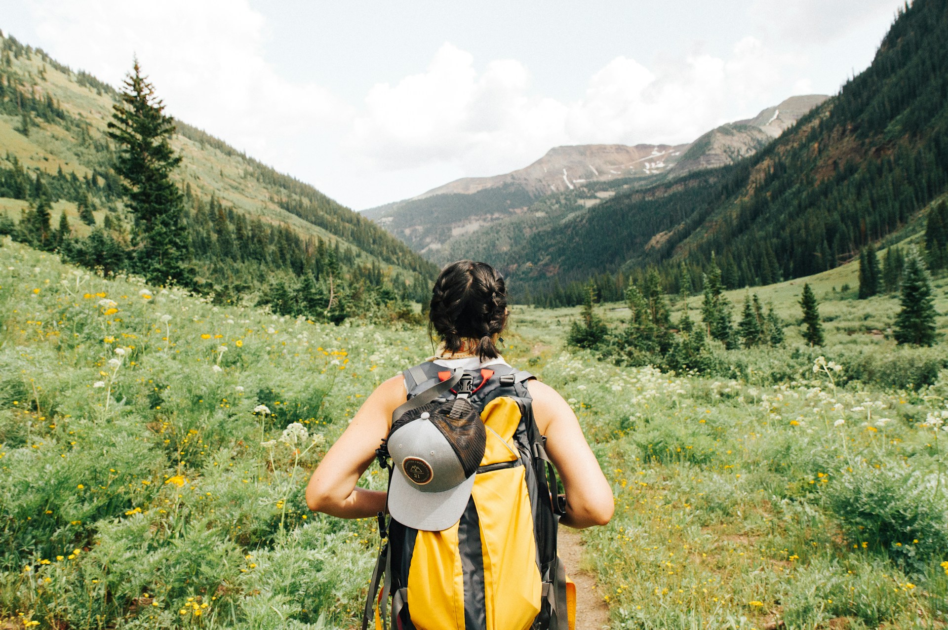
Choose Sapa if you want the rice-terrace mountains and hill-tribe culture on foot rather than from a saddle, you have less time (a 1–2 day trek fits any itinerary), you're travelling with family, older parents or kids, or you simply don't want to spend your holiday on a motorbike. You trek down into the Muong Hoa Valley, share a home-cooked lunch with a Black H'mong family, and sleep in a village homestay — the same northern-mountain magic, gentler and far more accessible. For most travelers, especially first-timers and families, it's the easier "yes".
The good news is that it is not strictly either-or. Plenty of travelers with two weeks do both — the Ha Giang Loop for the raw road-trip thrill, then a couple of gentle days trekking in Sapa to recover, both reached from the same base in Hanoi. If your time or appetite for risk is limited, though, and you can only pick one mountain experience, Sapa is the safer bet for the widest range of travelers.
Trek the Sapa Rice Terraces Instead
 1 Day TrekEasy
Trekking Through Rice Terraced Fields
The Muong Hoa Valley on foot with a local guide and a family lunch — mountain magic, no motorbike.
 2D1N HomestayModerate
Rice Terraced Fields & Homestay
Two days trekking the valley and a night with a local family — the deeper Sapa experience.
 Families & SeniorsVery Easy
Sapa Easy Trekking For Seniors
Gentle, flat paths with poles provided — the northern mountains for every age and fitness level.
Riding the loop after all? Smart packing makes the cold passes bearable — and if you add a Sapa trek to your trip, you don't need to fly with boots. Rent waterproof boots and poles at our office in town.
Boots & Poles for the Mountains
 Gear Rental$2/Day
Trekking Boots Rental
Waterproof ankle-support boots, cleaned and checked before each rental. At 105 Thach Son Street.
 Gear Rental$2/Day
Walking Poles Rental
Trekking poles at $2/day from our office at 105 Thach Son Street. Essential for the descents.
What to Pack for the Loop
You do not need much, but a few things make or break the trip. Bring warm layers and a windproof jacket (the passes are genuinely cold, even in summer), a rain poncho that covers both you and your bag, gloves, and sunglasses for the glare. Add sturdy closed shoes, a power bank, plenty of cash in small notes, any personal medication, and a small dry bag to keep electronics safe from rain and dust. Most bike shops and homestays can lend or sell the essentials you forget — but a cold, wet rider on Ma Pi Leng is a miserable one, so pack for the weather you might get, not the weather you hope for.
Tips for the Loop
- Don't rush. Four days beats three. The loop is about the stops — the viewpoints, the markets, the village kids waving — not the kilometres.
- Carry cash. There are few ATMs on the plateau and many places are cash-only. Bring enough for the whole loop in small notes.
- Pack for cold and rain. The passes are far colder than the lowlands; a warm layer and a rain poncho are essential even in summer.
- Fuel up when you can. Petrol stations are sparse in the remote sections — top up in every town.
- Respect the markets and villages. Ask before photographing people, buy something from the stalls, and go gently — this is a living community, not a theme park.
- Not a confident rider? Don't ride. Take an easy rider, a car tour, or choose a guided Sapa trek — our team confirms availability on WhatsApp in 5–10 minutes.