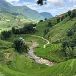
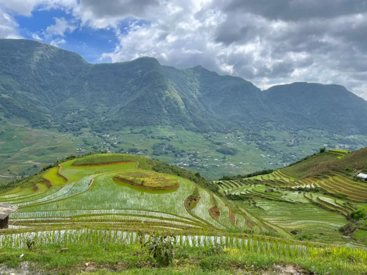
In September, when the paddies are three weeks from harvest, the Muong Hoa Valley looks like it was arranged by someone who had never heard of subtlety. The terraces step down both valley walls in tiers of gold and green, the Muong Hoa River catches the morning light at the bottom, and the whole thing sits in a corridor of mountains with Fansipan — 3,143 metres, the highest point in Indochina — occasionally visible at the northern end above the mist. I have walked this valley more times than I can count, in every season, and in September it is still the one that makes me stop on the ridge and look.
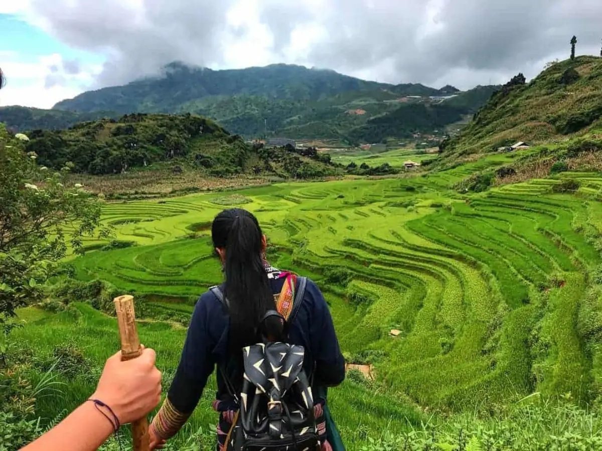
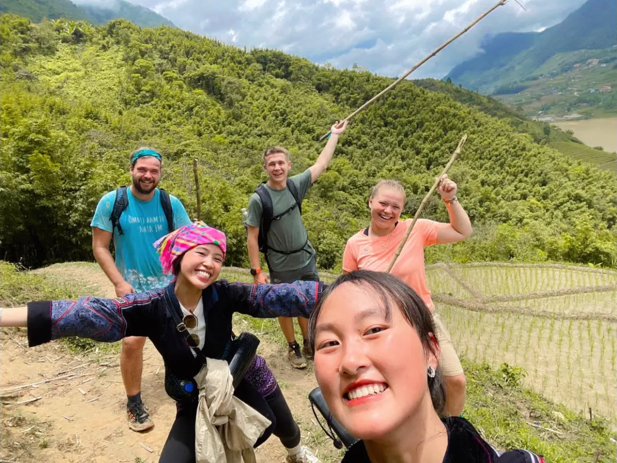
Our guides are Black H'mong, from Sapa. Their families have farmed rice in this region for generations, and they learned the paths of the Muong Hoa Valley as children — not from a map, but by walking them. Most visitors who come to Sapa see a fraction of what this valley actually contains. They walk the 8 km from Sapa to Ta Van, take photographs of the terraces, eat lunch at a family home, and leave. That is a real experience and worth doing. But the valley runs 17 km in total, it passes through seven distinct communities, it contains one of the most significant prehistoric rock art sites in Southeast Asia, and it has a trail network so complex that even experienced trekkers without a guide regularly end up in the wrong village. This guide covers the full picture.
What Is Muong Hoa Valley?
Muong Hoa Valley is the primary trekking corridor in the Sapa region — a 17 km valley running roughly northeast to southwest from the ridge above Sapa town down to the hamlet of Su Pan at the southern end. The Suoi Muong Hoa — the Muong Hoa River — runs along the valley floor the entire length, fed by streams from both valley walls. The rice terraces that define the valley were carved over generations by Black H'mong farmers working the hillsides by hand. The work continues today: the terracing is not a historical feature, it is an active agricultural system.
The valley sits between 900 metres elevation at the valley floor and 1,550 metres at the upper ridges on both sides. On a clear morning you can see Fansipan from the ridge above Lao Chai, though it is often hidden behind cloud by 10am. The terracing runs almost continuously up both valley walls — in some places the steps climb 400 metres from the river to the ridgeline, each terrace wall built from the same stones cleared from the field itself.
The Eight Villages of the Valley
Seven communities line the Muong Hoa Valley from north to south. Understanding which village is which — and who lives there — matters if you want to understand what you are walking through rather than just walking through it.
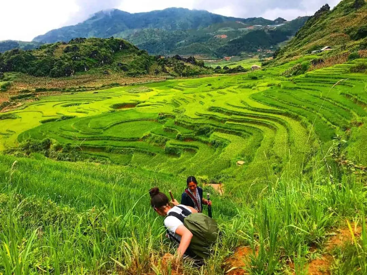
Y Linh Ho is the first Black H'mong community below the ridge above Sapa, small and compact, sitting at around 1,100 metres. Most trekking groups pass through the edges without stopping. Lao Chai comes next — the largest Black H'mong village on the standard route, about 6 km from Sapa, with a suspension bridge over the Muong Hoa River and the first lunch stops on the valley floor. The bridge crossing is one of the best vantage points in the valley, with the terraces rising behind it in both directions.
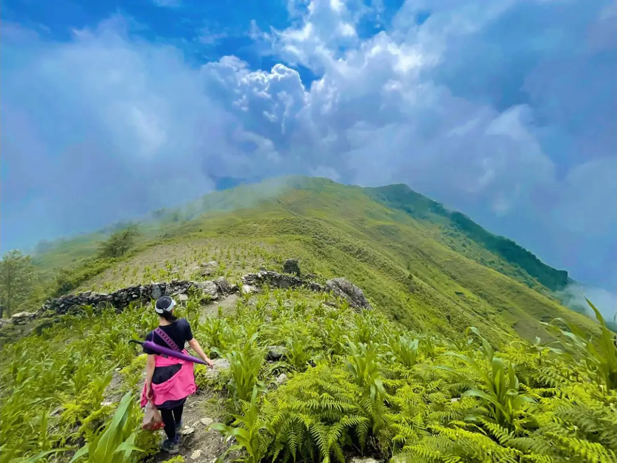
Across the river and 20 minutes south on the flat paddy path is Ta Van — a mixed community of roughly 200 Black H'mong households with a small number of Giay families at the southern end. Ta Van sits at 900 metres, the lowest and warmest point on the standard route, and it is the hub of the homestay network in the valley. South of Ta Van: Hang Da is smaller, quieter, and sees almost no organised tourism. Hau Thao is further south still, where the terraces give way to steeper hillside cultivation. Giang Ta Chai has a Giay weaving community worth visiting if you are on an overnight tour. At the far southern end, Su Pan is the terminus of the valley — rarely visited, accessible only to groups doing a full multi-day traverse.
One clarification that prevents a common mistake: Ta Phin, the Red Dao village regularly mentioned alongside Muong Hoa treks, is in a completely separate valley northeast of Sapa. Red Dao women are recognisable by their red headdresses and their distinctive indigo-and-red embroidery — different from the Black H'mong women in Muong Hoa Valley. Ta Phin is roughly 12 km from Sapa on a different road and requires a separate trip. Many tour packages combine both valleys in one day, but they are not part of the same route.
The Ancient Rock Carvings — Sa Pa Rock Art
About 6 km from Sapa, near the point where the trail reaches the Muong Hoa River at the valley floor, there is a cluster of large boulders that most trekking groups walk past without pausing. They should pause. These are the Sa Pa Ancient Rock Art petroglyphs — over 1,000 carvings etched into more than 200 boulders, dated by archaeologists to the Bronze Age, somewhere between 2,000 and 3,000 years ago. The site is among the most extensive prehistoric rock art collections in Southeast Asia and is on Vietnam's national heritage list as a UNESCO nomination candidate.
The carvings are geometric — spirals, rectangles, human figures, animals, and what appear to be diagrams of the valley landscape itself, the terraces and river rendered in abstract lines. The largest boulder is roughly the size of a car. I always stop my groups at it. You can run your hand along the carved lines and feel the depth of the cuts — some are 3–4 centimetres deep into the stone. The H'mong elders have their own names for the carvings; the official archaeological designation is formal and misses the local understanding that these marks are simply what the valley looked like to the people who were here first.
The main cluster sits on the western bank of the Muong Hoa River, slightly off the main trail. Without a guide who knows the location, it is entirely possible to complete the standard Lao Chai–Ta Van route and never see them. On our valley tours I build a 20-minute stop at the rock art into the route — it adds almost nothing to the distance and transforms the walk from a landscape experience into something with historical depth.
The Full Valley Trek — What the Route Looks Like
The standard 1-day trek starts from the southern edge of Sapa town and follows the ridge trail above the valley before descending. The first hour is the most physical: stone steps through forest, then a ridge walk at around 1,400 metres where the full width of the Muong Hoa Valley opens in front of you for the first time. This is the viewpoint most people photograph. On a clear morning the valley is in shadow at 7:30am and the light hits the upper terraces first, turning them gold before the floor wakes up.
The descent into Lao Chai takes about 45 minutes from the ridge. The path drops steeply through corn and cardamom terraces — cardamom is planted under forest canopy on the steeper slopes, and the smell when you pass through a stand of it is one of those specific sensory details that sticks: sweet, slightly medicinal, the green weight of it in the damp morning air. At the bottom, Lao Chai village. From Lao Chai the path to Ta Van is flat, following the river through paddy fields, crossing the suspension bridge at the midpoint.
The trail network in Muong Hoa Valley has more than 20 unmarked junctions on the valley floor alone. The paddy paths between Lao Chai and Ta Van split constantly — left or right along the terrace edge, up the hillside or down to the river. In dry season an experienced hiker can usually find the right path by reading the terrain. After rain, the paths flood and merge with the paddy edges and the correct route disappears entirely. South of Ta Van the forks multiply. I have been walking this valley since childhood and I still take a different route depending on the season and the water level.
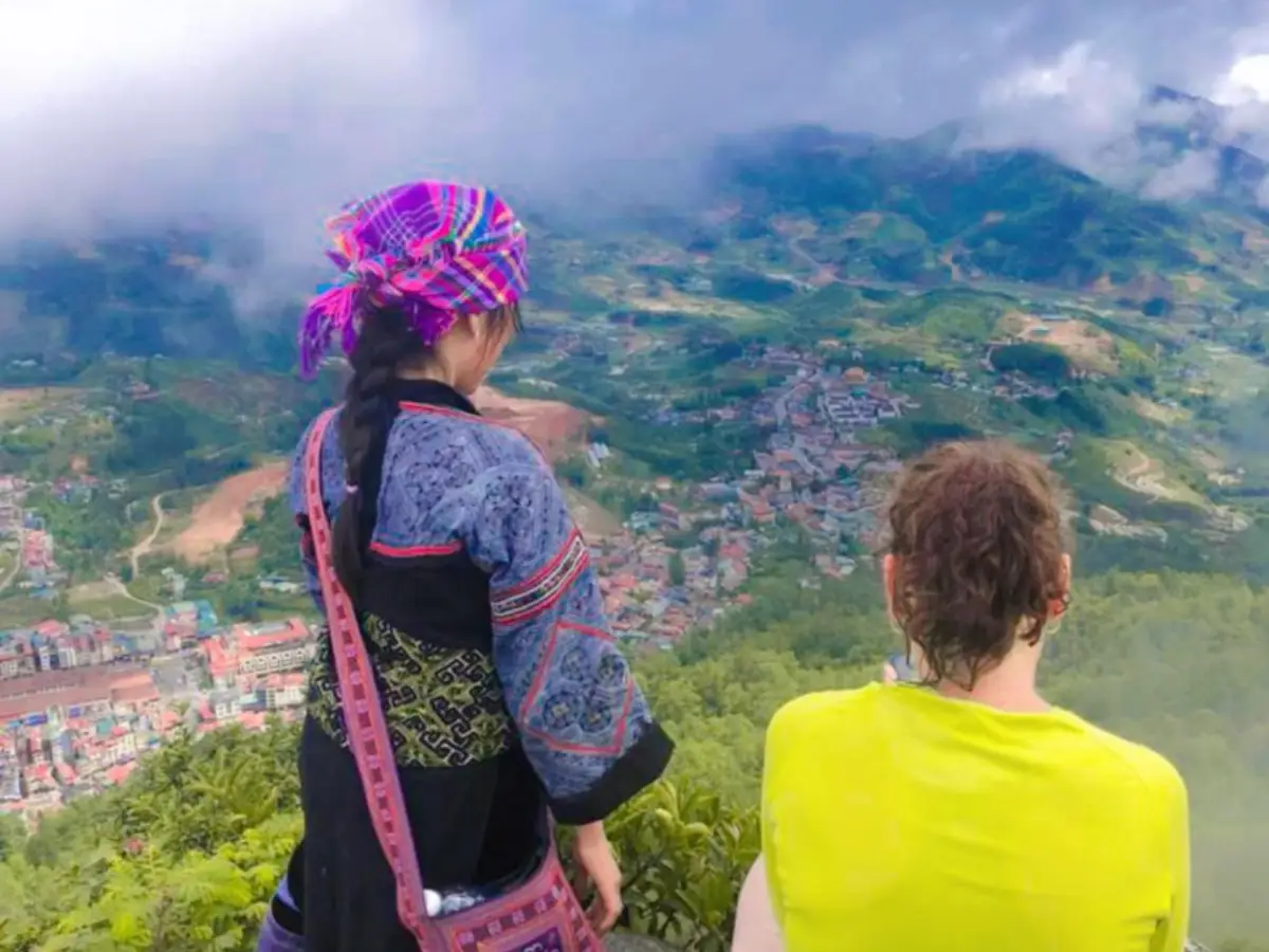
The best single viewpoint in the Muong Hoa Valley is the ridge trail above Lao Chai at dawn — arrive at the ridge by 7:30am, before the mist burns off, and you will see the valley floor in cloud with only the upper terrace steps visible above it. By 9am the mist is gone and it is a different valley entirely. We depart the office at 105 Thach Son Street at 7:30am specifically to hit this ridge at the right time.
Which Tours Go Through Muong Hoa Valley
Every trekking tour we run passes through the Muong Hoa Valley — it is the only route for genuine rice terrace trekking in the Sapa area. The difference between tours is how far south into the valley you go and whether you stay overnight.
The Trekking Through Rice Terraced Fields tour covers the classic northern section: the ridge descent, Lao Chai, the rock art boulders, the suspension bridge, and Ta Van for lunch. This is the 8 km / 3–4 hour route that most travelers describe when they talk about a Sapa day trek. The Mountain Views & Muong Hoa Valley Trek extends this with a second day heading south from Ta Van through Hang Da and Hau Thao, staying overnight with a Black H'mong family in the valley. For the full valley experience including Giang Ta Chai and the Giay weaving community, the 3-day tours are the correct format.
Tours Through Muong Hoa Valley
 Best Seller
Easy
Best Seller
Easy
Trekking Through Rice Terraced Fields
Classic valley walk — ridge descent, Lao Chai, ancient rock art, suspension bridge, Ta Van lunch. Best in September.
 Moderate
Mountain Views & Muong Hoa Valley Trek
Full valley traverse with overnight in Ta Van — Hang Da on day 2, terraces at dawn, quieter southern villages.
 Moderate
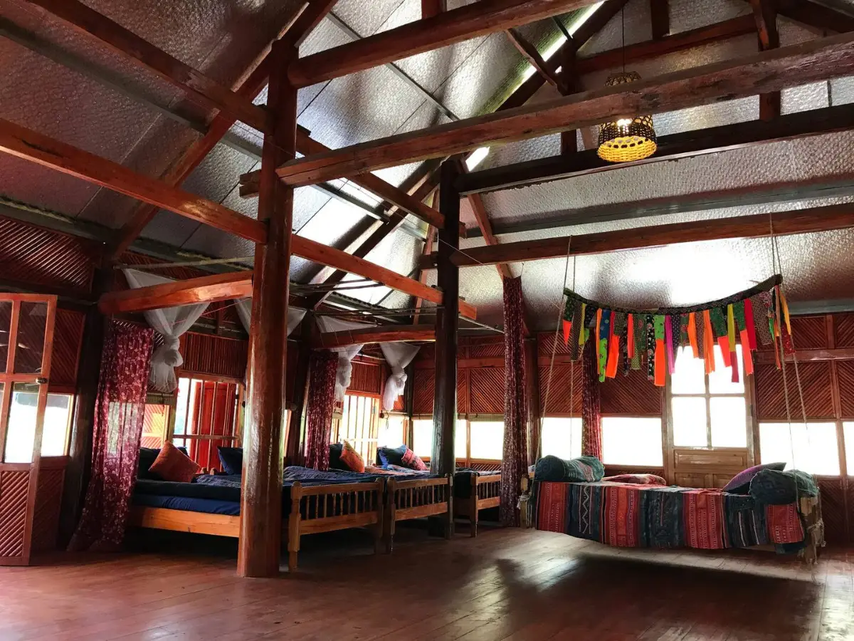
Rice Terraced Fields & Homestay
Overnight with a Black H'mong family in Lao Chai — home-cooked dinner, wood fire at 6am, valley before the day-trippers.
When to Trek Muong Hoa Valley
September and October are the months most of my repeat clients target. The rice on the upper terraces above Lao Chai starts turning from green to gold in the second week of September. By the end of the month the harvest is underway — families cutting by hand with small sickles, carrying sheaves down to the threshing floors at the terrace base. You can hear the hand-threshers from the trail. The light in October is cleaner than September: less haze, longer afternoon shadows, and on clear mornings the upper ridges above Sa Seng Mountain are sharp against a blue sky.
May and June are the other excellent window. The rice seedlings are transplanted in late April and by May the paddies are a green that almost looks artificial — bright, uniform rows of seedlings standing in flooded terraces, the water surfaces catching light between the plants. The weather in May is warm and relatively dry. June brings more afternoon cloud and occasional showers, but the valley is at its most lush and the trails are still in good condition. This is the period I recommend most for photographers who want the vivid green.
July and August are beautiful in their own way but I tell people honestly: the clay trails become genuinely difficult after heavy rain. Leeches appear on the lower paths below Lao Chai after wet weather — not dangerous, but unpleasant if you are wearing low shoes. The footpaths on the terrace edges flood and the rice paddy soil becomes the consistency of wet concrete. If you come in July or August, bring waterproof boots, walking poles, and realistic expectations about the trail surface.
November to February is dry season — cool, clear, dramatically quieter. The valley floor loses most of its colour after the harvest: cut stubble, black soil, the occasional burned field sending thin smoke up the valley sides. January mornings on the ridge above Lao Chai can produce some of the most photogenic mist conditions of the year, with the valley completely filled with cloud and only the upper terraces visible. By noon it clears and the mountains are visible all the way to Fansipan.
How the Trail Navigation Works — or Doesn't
The trail network in Muong Hoa Valley is not a single path. It is a system of paddy paths, ridge routes, village footpaths, stream crossings, and terrace edges that has been laid down over generations by farmers going about their daily work. None of it is signposted. The paths are maintained by use, not by any authority. After a flood season, a section that existed last year may simply be gone — washed out, overgrown, or rerouted by a new terrace wall.
The section from the ridge above Sapa to Lao Chai is the most clearly defined — a majority of trekking groups use it daily and the path is worn. Below Lao Chai, the trail network fans out into the paddy grid and the correct route depends on which village you are heading for, what season it is, and how high the river is running. I know of at least four different ways to get from Lao Chai to Ta Van. One of them is the tourist route. Two of them cross private terrace land where the owner does not appreciate strangers walking through. One of them only works in dry season when a particular stream is crossable by stepping stone.
Google Maps and apps like Maps.me show a rough outline of the valley road and a few marked trails near the most-visited sections, but they do not reflect the actual ground-level path network. Offline maps for this area are not reliable below the main track. Navigation is done by landmarks: a specific tree at a fork, the sound of the river versus the silence of the upper terraces, the angle of the valley wall. Our local guides navigate the southern section between Hau Thao and Giang Ta Chai by a sequence of rock formations named in childhood — there is no other way to describe them to someone who has not walked the route with them.
What to Bring for a Muong Hoa Valley Trek
Walking poles are the single most useful item for the Muong Hoa Valley. The descent from the ridge into Lao Chai is steep and the surface is clay — slippery in any moisture. The valley floor paths between terraces are narrow and often drop off sharply on one side. We keep poles at the office for groups who did not bring their own, available to borrow at no cost. If you are trekking during or after rain, poles are not optional.
- Walking poles — borrow from our office at 105 Thach Son Street, or rent from our gear station ($2/day)
- Rain jacket or poncho — Sapa weather changes in under 30 minutes; the valley is lower and warmer than town but afternoon rain in June to August is reliable
- Waterproof or trail shoes — road shoes fail on the clay descent; sandals are dangerous
- Sunscreen and hat — the upper ridge section is fully exposed for about 45 minutes with no shade
- 1.5–2 litres of water — there are no shops between Lao Chai and Ta Van on the trail; the only water source is the river
- Snacks for the mid-section — lunch is included in all our tours, but the 3-hour descent before lunch passes through no villages with food available
- Camera fully charged — the best light is on the ridge at 7:30–8:30am; phone batteries drop fast in cold morning air
- Light down layer — even in September, the ridge at 1,400 metres is cold before 8am
Rent at Our Office Before You Trek
 Gear Rental
$2/Day
Gear Rental
$2/Day
Trekking Boots Rental
Waterproof ankle-support boots. Cleaned and checked before each rental. Available at 105 Thach Son Street.
 Gear Rental
$2/Day
Gear Rental
$2/Day
Walking Poles Rental
Trekking poles available to rent at $2/day at our office, 105 Thach Son Street. Essential for descents.
Frequently Asked Questions
The full Muong Hoa Valley trek from the ridge above Sapa down to Su Pan is 17 km end-to-end and takes a full day of 6–7 hours walking. The most common day-trip route covers Sapa to Lao Chai to Ta Van — roughly 8 km / 5 miles and 3–4 hours on foot. Overnight treks continue south from Ta Van through Hang Da to Hau Thao, typically taking 2 days. The trail descends from about 1,550 metres at Sapa town to 900 metres at the valley floor, so most of the elevation loss happens in the first two hours.
The main villages in Muong Hoa Valley are, from north to south: Y Linh Ho, Lao Chai, Ta Van, Hang Da, Hau Thao, Giang Ta Chai, and Su Pan — seven Black H'mong and Giay communities spread along the 17 km valley corridor. Lao Chai and Ta Van are the two most visited, reachable on a standard 1-day trek from Sapa. Note that Ta Phin, the Red Dao village often mentioned alongside Muong Hoa treks, is in a completely separate valley northeast of Sapa and is not part of the Muong Hoa corridor.
Yes. The Sa Pa Ancient Rock Art site in Muong Hoa Valley contains over 1,000 petroglyphs carved on more than 200 boulders, dated to the Bronze Age — approximately 2,000 to 3,000 years old. The main cluster sits near the Muong Hoa River, about 6 km from Sapa town on the valley floor. The site is a UNESCO candidate and is one of the most significant prehistoric rock art collections in Southeast Asia. Most day-trippers walk past the carved boulders without noticing them — a local guide who knows the cluster can show you the largest piece, which is roughly the size of a car and appears to depict a map of the valley.
The main descent from Sapa to Lao Chai is manageable for confident walkers in dry conditions, but the trail network below Lao Chai — through the valley floor, across the paddy paths, and into Ta Van — has more than 20 unmarked forks. In wet season the rice terrace paths flood and become indistinguishable from the paddy edges. Without a guide who knows the valley personally, getting lost for an hour or two is common. South of Ta Van — through Hang Da and Hau Thao — the trails are almost impossible to follow correctly without local knowledge. Our local guides have walked every path in the valley since childhood and navigate by landmarks that do not appear on any map.
September and October are the best months — the rice is turning gold on the upper terraces and the harvest is underway across the valley, which produces the most dramatic landscape of the year. May and June are excellent for green paddy views and warm weather before the heavy rains begin. July and August are lush and beautiful but the clay trails become genuinely difficult after rain, with leeches appearing on the lower paths. November to February is the dry season — cool, clear, and much quieter. January can produce stunning clear mornings on the upper ridge, but the valley floor is cold at dawn.
The trekking trail into Muong Hoa Valley starts from the southern edge of Sapa town, dropping from the ridge above Y Linh Ho and Lao Chai down into the valley floor. By road, the valley road branches off the main Sapa-to-Ta Van route and takes about 20–25 minutes by motorbike or car to reach Lao Chai. All tours from the Trekking Tour Sapa office at 105 Thach Son Street start by walking the trail — departure is at 7:30am to reach the valley before the midday heat. We pick up from any hotel in Sapa town or you can meet us at the office.