
 Sinh Giang
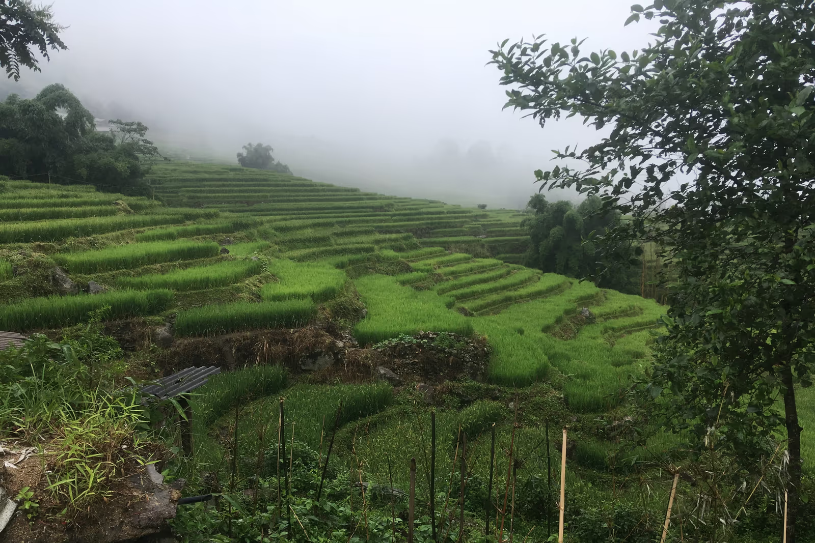
Ask a guide in Sapa where the crowds thin out on the Muong Hoa Valley trek, and most will point past Ta Van rather than at it. Keep walking south along the river past the last homestay sign, past the point where the trail stops being wide enough for two people to pass comfortably, and the terraces open onto Hau Thao — a scattering of Black H'mong houses with no centre, no market, and for most of the year, no other trekking group in sight.
Hau Thao isn't a destination tour operators sell on its own, and that's precisely the reason it stays this quiet. There's no road in, no admission gate, and since 2020 it hasn't even had its own name on a government map — it was folded into a larger commune, then folded again in 2025. None of that has emptied it out or erased it; it just means the only way most travelers reach it is on foot, as the middle stretch of a longer trek, which keeps the numbers low in a way that no amount of marketing could replicate at Lao Chai or Cat Cat.
This guide covers exactly where Hau Thao sits in the valley, what happened to it administratively, who lives there today, and how to actually walk into it — honestly, including the parts (navigation, facilities, distance) that other write-ups skip because they've never covered this stretch at all.
Hau Thao at a Glance
Hau Thao is a quiet stretch of scattered Black H'mong hamlets in the Muong Hoa Valley, south of Ta Van — here's what to know before you plan a route through it.
Where Hau Thao Is, Exactly
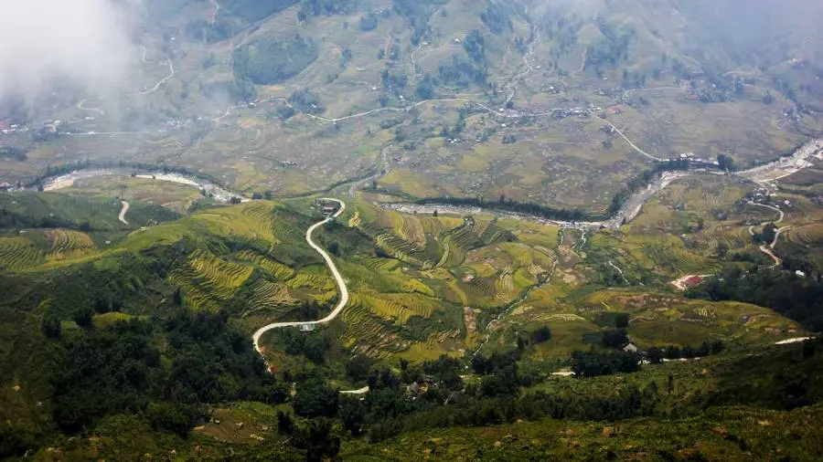
Hau Thao sits roughly 7 km from Sapa town as a straight line on the map, but that number is almost beside the point — there's no direct road, so nobody arrives that way. The practical route runs south from Sapa town through Y Linh Ho and Lao Chai to Ta Van, then continues on foot along the Muong Hoa River for another 2 km or so through the hamlet of Hang Da before the terraces open out into Hau Thao. From there, the valley keeps going south toward Giang Ta Chai and finally Su Pan, where the trekkable trail runs out.
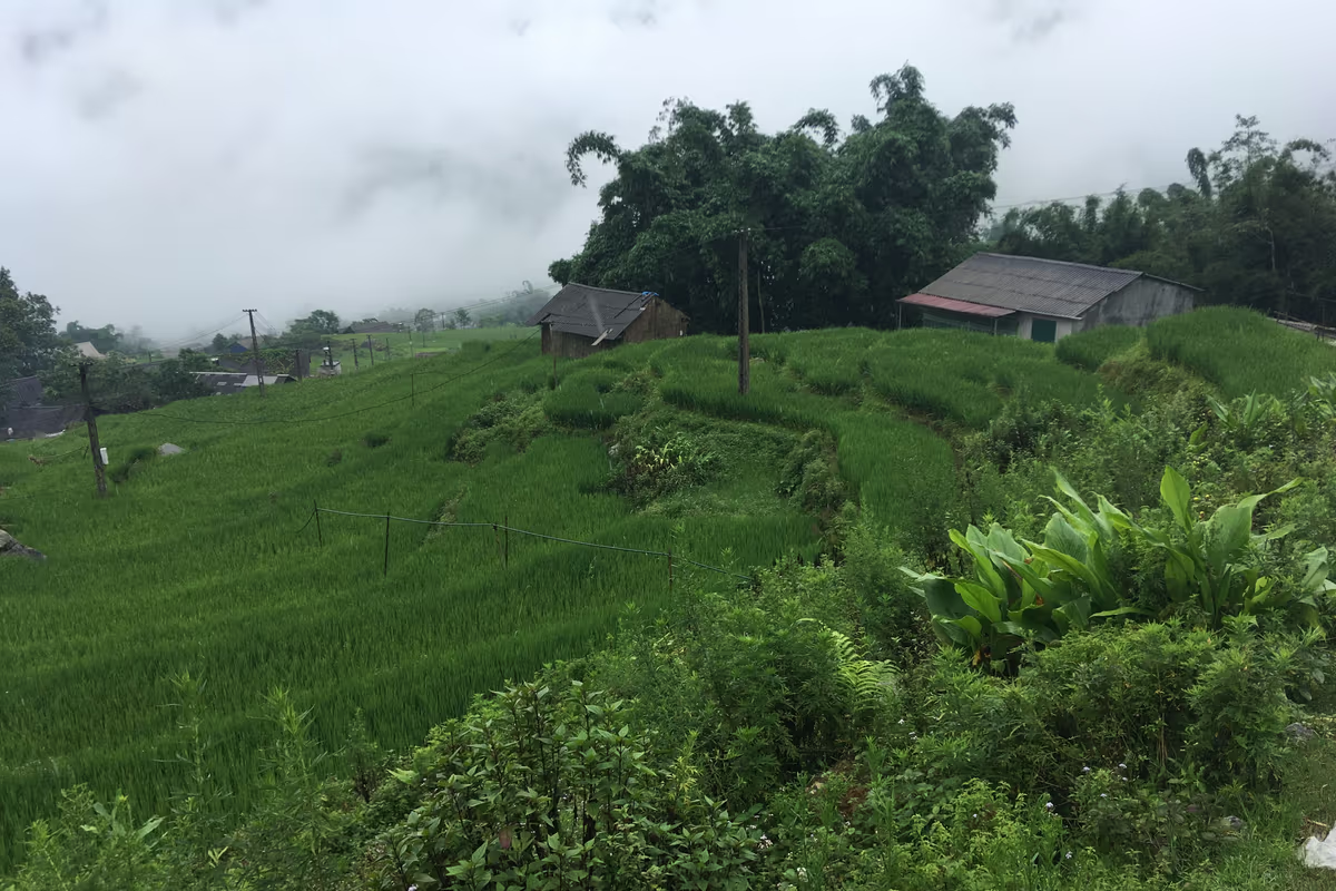
Geographically, Hau Thao is simply a continuation of the same valley floor and lower slopes you'd see at Ta Van — there's no dramatic change in landscape marking an entrance, no sign reading "Welcome to Hau Thao." What changes is density: houses become sparser, spaced across the hillside rather than grouped near the river, and the trail itself narrows and gets noticeably less travelled. Our own research on the wider Muong Hoa Valley corridor found this stretch has a reputation among local guides as the point where casual day-trippers turn back and only the overnight groups continue.
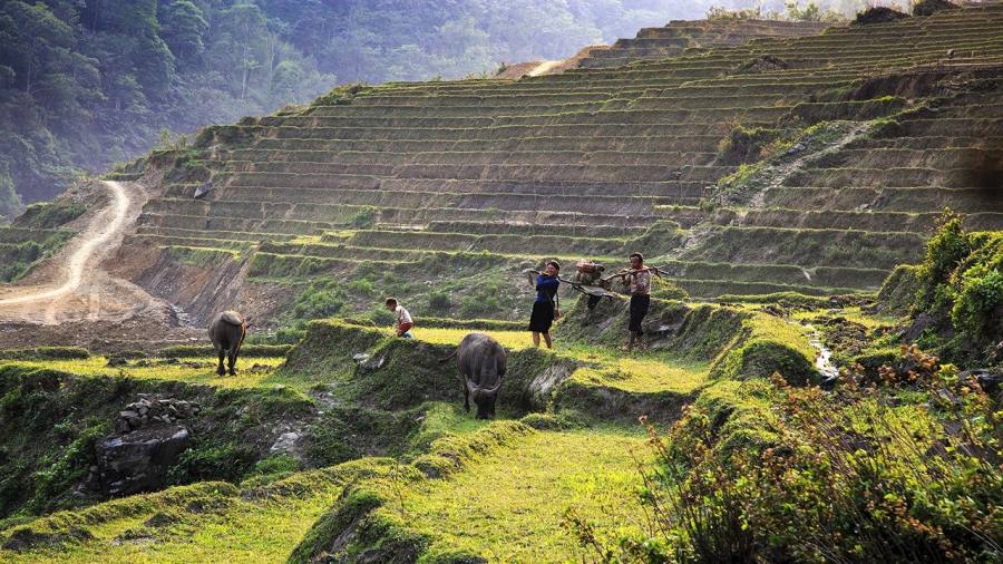
Fansipan's summit ridge is usually out of view by the time you reach Hau Thao — the valley walls close in and the terraces take over the skyline instead. What you do get, especially on an overcast morning, is the sense of being genuinely inside the working landscape rather than looking at it from a viewpoint: terraces climbing the slope on both sides, the Muong Hoa River running low and brown below, and houses appearing one or two at a time rather than in a cluster.
Timing changes the feel of the walk more than almost anywhere else in the valley. Arrive in the hour after sunrise and the terraces are often still holding mist in their lower folds, with the sound of the river carrying further than it does once the day's farm work is underway. By mid-morning that mist has usually burned off and households are visibly active — someone turning soil, someone else carrying water up from the stream — which makes it a better window for seeing daily life in motion, if a less atmospheric one for photographs. Guides who know the stretch well tend to time a Hau Thao passage for mid-morning on purpose, balancing both.
A Village That Lost Its Name on the Map
Hau Thao was its own commune — a proper administrative unit with its own council and boundaries — until 1 January 2020, covering 8.81 km² and a population of 2,932 people at the time. That year, Vietnam's National Assembly Standing Committee merged it with neighbouring Su Pan commune under Resolution 767/NQ-UBTVQH14, creating a new unit called Muong Hoa commune (not to be confused with the Muong Hoa Valley itself, the much older geographic name for the whole trekking corridor).
Muong Hoa commune didn't last either. On 1 July 2025, as part of a province-wide restructuring of Lao Cai under Resolution 1673/NQ-UBTVQH15, it was merged again — this time together with Hoang Lien commune and the old Ta Van commune — into a single, much larger Ta Van commune covering 158.5 km² and roughly 18,600 people. That's the administrative unit Hau Thao technically belongs to as of this writing.
None of this changes what you'll find on the ground. Locals, guides and homestay hosts still say "Hau Thao" the same way they always have, the same way people south of here still say "Giang Ta Chai" even though that hamlet went through an identical administrative history. What the mergers mean in practice is that there's no Hau Thao commune office to visit, no separate village sign, and increasingly few official records that treat it as a distinct place — only the terraces, the houses, and the name people keep using for them.
Because Hau Thao isn't an administrative unit anymore, you won't find it as a pin on most mapping apps or a destination in most booking systems. If you're arranging a trek yourself rather than through a guide, search for "Ta Van commune" or "Muong Hoa Valley" trail maps instead, and confirm with whoever you book through that their route actually continues past Ta Van this far south.
Who Lives in Hau Thao
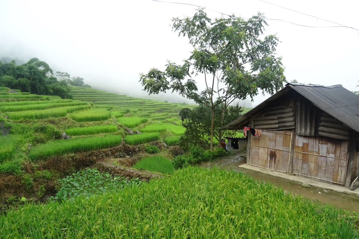
Hau Thao is home to Black H'mong families, the same ethnic community found further north in the valley at Lao Chai, Y Linh Ho and Sin Chai, distinct from the Giay households clustered around Ta Van and the Red Dao communities at Ta Phin and Giang Ta Chai. Houses here are built from timber planks and woven bamboo rather than brick, raised slightly off the ground, and roofed in thatch or corrugated sheet — practical materials for a hillside with no vehicle access for heavier building supplies.
Rice is still the backbone of daily life. Families work the terraces that step down the slope toward the river, planting in spring and harvesting in autumn on the same cycle followed across the whole Muong Hoa Valley, supplemented with corn and vegetables on the steeper, drier ground above the paddies. A smaller number of households take overnight guests through arrangements with local guides and tour operators, which is the closest thing Hau Thao has to a tourism economy — there's no souvenir stand, no fixed-menu restaurant, and no scheduled "cultural show."
That absence of infrastructure is exactly what distinguishes a walk through Hau Thao from a stop in Ta Van or Lao Chai. You're passing through working households on an ordinary day, not a stretch of trail built up around visitors. What you notice depends entirely on timing and pace: a family drying chillies on a bamboo mat, someone carrying feed to a pen of pigs, children walking the long route home from the school down in Ta Van.
What You'll Actually See Walking Through
There's no single landmark to point a camera at in Hau Thao — what defines the stretch is a combination of terrain, spacing and quiet that's hard to find anywhere closer to Sapa town.
How Hau Thao Fits Into a Multi-Day Trek
Hau Thao works as a waypoint, not a destination — every route that reaches it treats it as part of a longer walk rather than the goal itself. The most common version starts in Sapa town, follows the classic descent through Y Linh Ho and Lao Chai to Ta Van for lunch or an overnight stay, then continues south the next morning through Hang Da into Hau Thao before either turning back or pushing on toward Giang Ta Chai and Su Pan.
Our 2-day Mountain Views & Muong Hoa Valley Trek reaches Hau Thao on its second day before turning back, covering around 27 km across the full itinerary with one overnight homestay. For travelers with more time, the 3-day Experience The Real Sapa route continues through Hau Thao to Giang Ta Chai with two nights in local homes, and the Sapa Valley Trek & Homestay covers similar ground at a gentler daily pace. None of these treat Hau Thao as a stop with its own schedule — your guide decides the exact pace and rest points based on the group and the weather that day.
A typical second day on the 2-day route leaves the Ta Van homestay after breakfast, covers the roughly 2 km to and through Hau Thao in the first hour or two of walking while the ground is driest, pauses there for a rest and a look back across the terraces toward Ta Van, then either loops back north toward Sapa town or continues south if the itinerary extends to Giang Ta Chai. There's no fixed lunch spot inside Hau Thao itself the way there is in Lao Chai — your guide usually carries food for this stretch or times the day around a meal back in Ta Van or further along the route, depending on which direction you're headed.
Multi-Day Treks That Reach Hau Thao
 2D1N
2D1N
Mountain Views & Muong Hoa Valley Trek
Y Linh Ho, Lao Chai, Ta Van, Hang Da and Hau Thao — 27 km across 2 days, one overnight homestay.
 Best Seller
Experience The Real Sapa
Three days through the full valley — Ta Van, Hang Da, Hau Thao, Giang Ta Chai. Two nights with local families.
Sapa Valley Trek & Homestay
A gentler-paced 3-day version of the same valley route, with two nights in Black H'mong and Giay homes.
Finding the Trail: Why You Shouldn't Try This Unmarked
The path south of Ta Van is where the well-trodden tourist trail effectively ends. Our research into the wider Muong Hoa Valley counted more than 20 unmarked forks between Ta Van and the villages further south, and in the wet season the rice-terrace paths flood and blur into the paddy edges, making them genuinely hard to distinguish from solid ground. South of Ta Van specifically — through Hang Da and into Hau Thao — local guides describe the trail network as close to impossible to follow correctly without having walked it before.
Best Time to Visit Hau Thao
The best months to walk through Hau Thao are September and October, when the terraces turn gold ahead of the rice harvest, and March to May, when the fields are freshly planted, green, and the trail is at its driest.
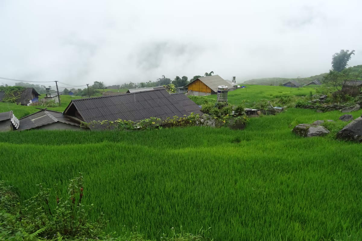
The photographs in this guide were taken in early August, during the wet season — the terraces are a deep, uniform green with the rice heads not yet showing, and low cloud sits over the ridgelines most mornings. It's a genuinely beautiful time to see the valley at its most lush, but it's also when the unmarked paths south of Ta Van are at their most treacherous underfoot, which is one more reason this stretch favours a guided trek over a solo attempt in these months.
Hau Thao Compared to Ta Van, Hang Da and Giang Ta Chai
Of the stops on the Muong Hoa Valley's southern half, Hau Thao sits in the middle of the spectrum between Ta Van's homestay infrastructure and the near-total quiet of Su Pan at the far end of the trail.
- Ta Van — the hub of the valley's homestay network, down by the Muong Hoa stream, home to Giay families as well as Black H'mong; the last point with reliable facilities before the trail gets harder to follow.
- Hang Da — smaller and quieter again, immediately south of Ta Van, with almost no organised tourism of its own.
- Hau Thao — scattered Black H'mong households across open terraced slopes, no commune office, no shops, reached only as part of a longer trek.
- Giang Ta Chai — a Red Dao village further south, paired with a bamboo forest and waterfall, a common turnaround point for 2- and 3-day treks.
If you only have one day in the valley, Lao Chai and Ta Van will give you the easier, more social half of the walk with lunch and facilities included. Pushing on to Hau Thao is what turns that day into a proper multi-day trek — it's the stretch most guides mean when a traveler asks for something genuinely off the usual circuit, rather than just a quieter version of the same photo everyone else takes.
Rent at Our Office Before You Trek
 Gear Rental
Trekking Boots Rental
Waterproof ankle-support boots. Cleaned and checked before each rental. Available at 105 Thach Son Street.
 Gear Rental
Walking Poles Rental
Trekking poles available to rent at $2/day at our office, 105 Thach Son Street. Useful for the unmarked ground south of Ta Van.
Visiting Hau Thao Respectfully
Hau Thao is a place people live and farm, not a stop built for visitors, and it's worth walking through it with that plainly in mind. Ask before photographing anyone directly, particularly older residents and children — most people will say yes to a polite request, and a "no" should be respected without argument. If a family does invite you in for tea, treat it as a genuine social visit rather than a quick photo stop.
There's no fixed souvenir trade here the way there is in Ta Van, but if you're offered handwoven textiles or other handicrafts directly from a household along the way, buying them puts money straight into that family rather than into a shop in town. Prices aren't fixed, so a friendly, fair negotiation is normal; aggressive haggling over small sums isn't a good look on either side.
It's also worth being honest with yourself about expectations. Hau Thao has none of the "cultural village" staging some travelers expect from a Sapa itinerary — no scheduled performance, no entrance fee, no gift shop. What you get instead is an ordinary working day in someone else's home valley, which some visitors find underwhelming precisely because nothing has been arranged for them to see.
A licensed local guide, navigation through the unmarked stretch south of Ta Van, and an arranged homestay or meal with a local family are all included whenever a route through Hau Thao is part of your itinerary — no separate bookings needed on your end. Walking poles can be rented at our office if you need them.
Practical Tips for This Stretch of the Valley
A handful of details separate a smooth walk through Hau Thao from a genuinely difficult one — most of them come down to preparation rather than fitness.
- Guide: treat one as close to essential south of Ta Van — this is not the stretch to learn valley navigation on your own.
- Footwear: the same grippy trekking shoes you'd want for the rest of the valley; the clay paths here get just as slick as further north.
- Water and snacks: bring enough for a full day — there's nowhere reliable to buy either once you're past Ta Van.
- Cash: small Vietnamese dong notes if you want to buy handicrafts directly from households along the way.
- Overnight stays: arrange a homestay in advance through your guide or operator; you can't reliably find one by showing up.
- Timing: plan this as day two (or later) of a multi-day trek rather than trying to reach and return from Hau Thao in a single day from Sapa town.
Frequently Asked Questions
Hau Thao sits in the Muong Hoa Valley about 2 km south of Ta Van, roughly 7 km from Sapa town as the crow flies — further on foot, since the valley trail winds with the river rather than running in a straight line. It's reached by continuing south past Ta Van and Hang Da rather than by a direct road from Sapa, so most visitors see it as the middle stretch of a two-day trek rather than a standalone day trip.
Not as its own administrative unit, though the name is still very much in use on the ground. Hau Thao was an independent commune until 1 January 2020, when it was merged with neighbouring Su Pan to form Muong Hoa commune. That commune was folded again on 1 July 2025, together with Hoang Lien and the old Ta Van commune, into a single larger Ta Van commune under Lao Cai province's nationwide restructuring. Hau Thao today is a place-name for a stretch of hamlets and terraces, not a government office — the same situation as nearby Giang Ta Chai.
Black H'mong families, the same ethnic community found in Lao Chai, Y Linh Ho and Sin Chai further north in the valley. Houses are built from timber and bamboo, spaced out across the hillside rather than clustered into a village centre, and most households still farm terraced rice as their main livelihood alongside a small amount of homestay income from passing trekking groups.
It's part of the longer Muong Hoa Valley corridor, not a trek in its own right. The standard way in is on foot from Ta Van, continuing south through Hang Da — there's no direct vehicle road, and no tour sells "Hau Thao" as a stand-alone destination. Our 2-day Mountain Views & Muong Hoa Valley Trek reaches Hau Thao and turns back; the 3-day Experience The Real Sapa and Sapa Valley Trek & Homestay routes continue through it toward Giang Ta Chai and Su Pan.
The walk itself is a steady, moderate climb and descent rather than a technical trek, but the navigation is the real difficulty. Our own Muong Hoa Valley research found more than 20 unmarked forks between Ta Van and the southern villages, and locals say the stretch through Hang Da and Hau Thao is close to impossible to follow correctly without knowing the ground personally. Most independent travelers who try this section end up backtracking or hiring a local guide on the spot once they see how unmarked it is.
Not reliably along the open trail. Hau Thao has no cafes, shops or public restrooms the way Ta Van does — a handful of households take overnight homestay guests by prior arrangement through a guide or tour operator, but you can't simply walk in and find a room or a meal. Bring your own water and snacks, and treat any stop here as something your guide has arranged in advance rather than something you'll find on the spot.