 Sinh Giang
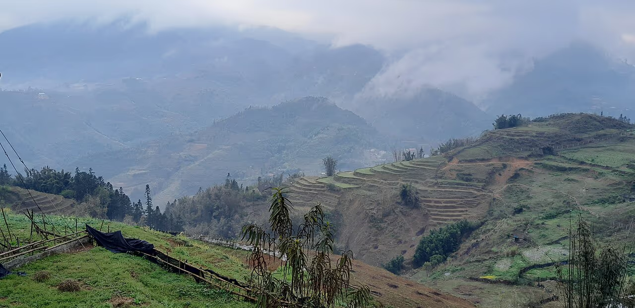
The trailhead above Y Linh Ho doesn't look like much from the road — a gap in the hedge, a dirt track dropping away between two terraces, no sign, no gate. Then you take the first few steps down and the whole Muong Hoa Valley opens up below: rice terraces cut into a slope so steep it seems impossible to farm, wood-and-thatch houses scattered rather than clustered, and the sound of a rooster somewhere below that you can't yet see. This is where almost every "Lao Chai-Ta Van trek" actually starts, even though the name on the tour listing never mentions it.
Y Linh Ho is the first of three villages on Sapa's classic valley walk, and the one travelers know least about — it has no market, no cluster of guesthouses, and no single "sight" to point a camera at. What it has is the steepest, quietest, most physically real stretch of the whole trek: the part where you actually feel like you're walking into Black H'mong farmland rather than through it. This guide covers exactly where Y Linh Ho sits, who lives there, what the walk through it really demands, and how to see it properly — on foot, with enough respect for the people whose homes you're passing.
Most write-ups of the "Lao Chai-Ta Van trek" skip Y Linh Ho entirely and start the story at the valley floor, because that's the flatter, more photogenic half of the walk. That leaves a gap: the village that gives the trail its character, and its difficulty, barely gets a name-check. This guide fills that gap on its own terms.
Y Linh Ho at a Glance
Y Linh Ho is a small, scattered Black H'mong hamlet on the upper rim of the Muong Hoa Valley — here's what to know before you go.
Where Is Y Linh Ho, Exactly?
Y Linh Ho sits about 6 km south-east of Sapa town, on the upper slopes of the Muong Hoa Valley, roughly a kilometre before Lao Chai and around 3 km before Ta Van. There is no paved road into the hamlet — a dirt track connects it loosely to the highway above, but the village itself is reached by walking down from a trailhead on the ridge. On a private car or motorbike, that trailhead is a five- to ten-minute drive from our office at 105 Thach Son Street; on a guided tour, we handle that transfer as part of the trek, so you never have to find the turn-off yourself.
What makes Y Linh Ho distinct from Lao Chai and Ta Van is elevation and spread. Where Lao Chai fans out across a wide, relatively gentle terrace and Ta Van sits down by the Muong Hoa stream, Y Linh Ho's houses are strung out across a much steeper hillside, each family working whatever flat ground it could carve into the slope. You rarely see more than two or three houses at once; most of the hamlet is hidden around a bend or below a ridge, which is part of why first-time visitors often walk straight through without realizing they've been in Y Linh Ho at all.
The trailhead itself sits high enough that, on a clear morning, you can pick out Fansipan's summit ridge to the west and trace the switchbacks of O Quy Ho Pass on the far side of the valley before you've taken a single step downhill. Guides use that first view as the day's orientation point — Sapa town behind you, the whole walk to Ta Van laid out ahead, the Muong Hoa river a thin silver line at the bottom.
A Short History: Why the Trail Starts Here
Sapa developed as a French hill station in the early 1900s, valued by colonial administrators for its cool climate rather than its trekking. Organized trekking tourism into the Muong Hoa Valley only really took hold from the 1990s onward, once Vietnam opened more widely to foreign visitors and word spread about the terraces and the H'mong and Dao villages that farmed them. Y Linh Ho became the trailhead almost by geography rather than design — it's simply the first inhabited ground you reach once you drop off the ridge above Sapa town, so any walking route into the valley from town passes through it first.
That accident of geography is also why Y Linh Ho never developed the small tourist infrastructure that grew up in Lao Chai and Ta Van over the following decades — those villages became overnight stops and lunch spots, with an economic reason to build guesthouses and simple restaurants. Y Linh Ho, being a place you walk through rather than stop in, stayed a working hamlet. Locals sometimes call the descent "the old trail" to distinguish it from the newer, gentler road-side entry points further down the valley that some tour operators now use to shorten the walk.
If you're driving yourself and want to see Y Linh Ho rather than just the trailhead, ask specifically for the "old Y Linh Ho trail" drop-off — some drivers default to a lower point on the road that skips the steepest, most scenic section entirely.
Who Lives in Y Linh Ho — the Black H'mong of the Upper Valley
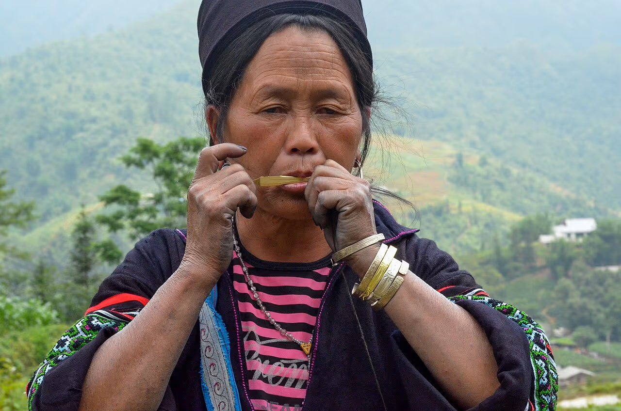
Y Linh Ho is home to Black H'mong families, part of the same ethnic community found in Lao Chai, Sin Chai and Cat Cat, distinguished from the Red Dao of Ta Phin by their indigo-dyed hemp clothing and their farming of the valley's steepest, thinnest terraces. Households here grow wet rice on whatever terrace ground they have and corn on the drier slopes above it, and many still keep water buffalo for ploughing rather than machinery — the terrain is simply too steep and fragmented for anything larger.
Hemp and indigo remain part of daily life rather than a display staged for visitors. Women grow and beat hemp fibre by hand, dye it repeatedly in indigo vats until the cloth darkens toward black-blue, then hand-embroider and hem the finished skirts and jackets — a process that can take weeks per garment. "People think the clothes are just for photos," says Tzu Hang, one of our guides who grew up in a Black H'mong village near here. "My mother was still dyeing hemp the week before I left for school. It's work, not costume." Seeing that process in progress — a length of cloth drying on a fence, a pot of indigo by a doorway — is one of the small, easy-to-miss details that separates walking through Y Linh Ho from walking through a village staged for tour buses.
Houses in Y Linh Ho follow the same basic pattern found across Black H'mong hamlets in the valley: timber plank walls, a packed-earth or wooden floor, and a roof of thatch or corrugated sheet, built low against the wind that runs up the valley in winter. Most homes sit on a single level with the family's rice store built separately alongside, raised off the ground on posts to keep grain away from damp and rodents. There is no cluster of shops or a central square — each homestead is largely self-sufficient, growing its own rice and vegetables and raising pigs and chickens in a small enclosure near the house.
What You'll Actually See Walking Through
Three things define the walk through Y Linh Ho, and none of them are a built attraction — they're just what the hillside and the households look like on an ordinary working day. There's no admission gate, no craft-demonstration stage, and no fixed viewpoint marked with a sign; what you notice depends entirely on how slowly you're willing to walk and how much your guide chooses to point out.
How Y Linh Ho Fits Into the Lao Chai-Ta Van Trek
Y Linh Ho is the starting village of the route most travelers simply call the Lao Chai Ta Van trek — the classic single-day walk through the Muong Hoa Valley. Starting at the trailhead above Y Linh Ho rather than driving further down the valley is what makes a trek "the full version" rather than the shortened, easier variant some tours quietly substitute. From the ridge, the trail drops through Y Linh Ho's terraces to the valley floor, follows the Muong Hoa stream to Lao Chai for a home-cooked lunch, then crosses the valley to finish in Ta Van, home to the Giay people as well as more H'mong families.
Total distance for the full route runs 10 to 14 km depending on the exact path and where the vehicle drops you, or four to six hours of walking with rest stops. Skip Y Linh Ho and start lower down at Lao Chai instead, and you cut out the steepest, most physically demanding — and most rewarding — hour of the day.
Near the bottom of the Y Linh Ho descent, where the trail finally levels out and meets the Muong Hoa River, you pass close to the edge of the Sa Pa Ancient Rock Art site — over 1,000 Bronze Age petroglyphs carved into more than 200 boulders scattered along the valley floor. Most groups walk within a few hundred metres of them without stopping; ask your guide to detour the short distance if you want to see the carvings up close, since they're easy to miss if you're focused on the last stretch before lunch in Lao Chai.
The First Hour: What to Expect
The descent out of Y Linh Ho is the part of the day your legs will remember. Narrow dirt paths switch back between terraces, dropping in short, steep sections rather than a gradual slope, and there's very little shade until you're most of the way down. It's not technical — no ropes, no scrambling — but it does demand attention to footing, especially where the path narrows to the width of a terrace wall. Guides set the pace to the group and point out where the ground is loose, but this is genuinely the harder half of the day, front-loaded rather than saved for later.
Roughly halfway down, the path crosses a couple of small wooden footbridges over irrigation channels that feed water from higher terraces to lower ones — a simple gravity system that's been maintained by hand for generations and still keeps every paddy in the hamlet watered without a single pump. It's a good spot to pause, both for the view back up at the terraces you've just descended and for the chance to see how the whole hillside's water supply actually works.
Best Time to Visit Y Linh Ho
The best months to walk through Y Linh Ho are September–October, when the terraces turn gold just before the rice harvest, and March–May, when the fields are freshly planted and green and the descent is at its driest and safest.
Winter (December–February) brings genuine cold and mist that can sit in the valley all morning — atmospheric, and far quieter on the trail, but pack a proper jacket; Sapa's mountain winters catch a lot of travelers off guard. Early morning starts, whatever the season, mean cooler walking temperatures and a good chance of watching mist lift off the terraces below Y Linh Ho before the day's other trekking groups arrive.
Walk the Full Route From Y Linh Ho
 Seniors & Families
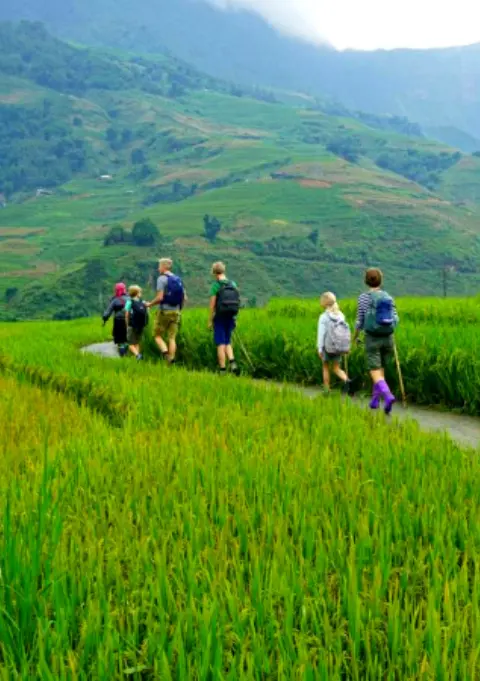
Sapa Easy Trekking For Seniors
A gentler take on the Y Linh Ho & Ta Van route — walking poles provided, pace set to the group.
 Best Seller
Trekking Through Rice Terraced Fields
The full valley walk from the Y Linh Ho ridge through Lao Chai to Ta Van — best September–October.
Rice Terraced Fields & Homestay
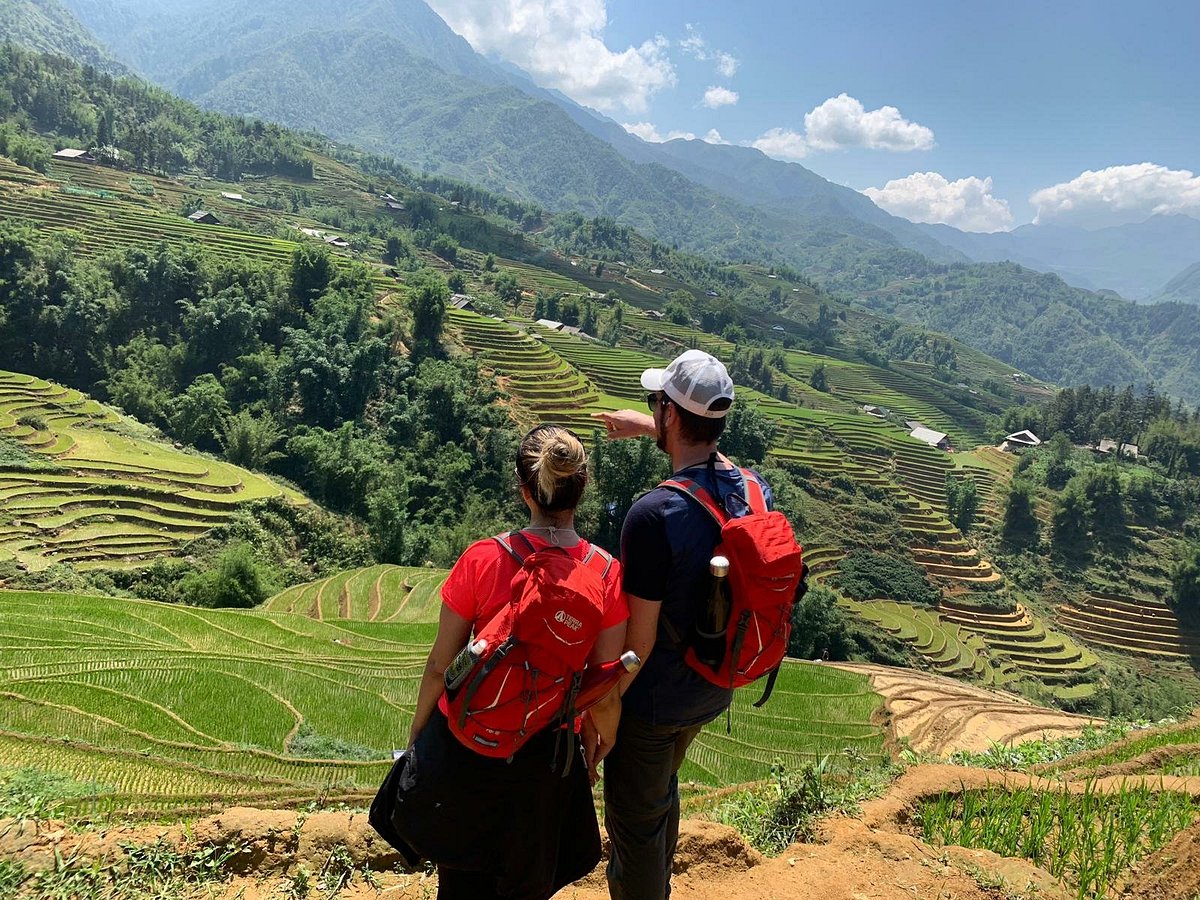
Walk from Y Linh Ho to a Black H'mong homestay in Lao Chai — dinner with the family, terraces at dawn.
Y Linh Ho Compared to Lao Chai, Ta Van and Ta Phin
Of the villages on the classic trekking circuit, Y Linh Ho is the closest to town but the least developed for tourism — a trade worth understanding before you decide where to focus your day.
- Y Linh Ho — steepest and quietest, no facilities, purely a trail-through hamlet, Black H'mong.
- Lao Chai — the largest Black H'mong village on the route, wider terraces, the usual lunch stop with small restaurants.
- Ta Van — down by the Muong Hoa stream, home to the Giay people and the main homestay hub for overnight treks.
- Ta Phin — a separate valley entirely, largely Red Dao, known for the herbal bath tradition rather than the Muong Hoa trail.
If your time in Sapa is short and you can only walk one stretch, Lao Chai to Ta Van gives you the easier, more social half of the valley. Adding Y Linh Ho to the front of that walk is what turns a pleasant afternoon stroll into an actual trek — it's the difference most travelers mean when they ask a guide for something "less touristy."
Rent at Our Office Before You Trek
 Gear Rental
Trekking Boots Rental
Waterproof ankle-support boots. Cleaned and checked before each rental. Available at 105 Thach Son Street.
 Gear Rental
Walking Poles Rental
Trekking poles available to rent at $2/day at our office, 105 Thach Son Street. Essential for the Y Linh Ho descent.
Visiting Y Linh Ho Respectfully
Y Linh Ho is a place people live and farm, not a heritage site or an open-air museum, and the way you walk through it should reflect that. Ask before photographing anyone directly, especially older residents and children — a smile and a raised camera asking permission is usually enough, and a "no" should end the conversation there. If a family invites you in for tea, it's polite to accept briefly rather than treat the invitation as a photo opportunity to rush through.
If local women offer handwoven or embroidered pieces along the trail, buying directly from them puts money straight into the household that made it — a meaningfully different transaction from buying the same style of item in a Sapa town souvenir shop. Prices are rarely fixed; a fair, friendly negotiation is normal and expected, aggressive haggling over small amounts is not.
It's also worth saying plainly what Y Linh Ho is not: it is not a re-created "cultural village" with paid performers, and it is not set up to sell you anything at every turn. Some travelers arrive expecting the more commercial pace of Cat Cat and come away confused by how quiet it feels. That quiet is the point — it means the households you're walking past are living an ordinary day, not one staged for visitors passing through.
A licensed local guide, transport to the trailhead above Y Linh Ho, walking poles if you need them, and a home-cooked lunch in Lao Chai are included on every guided trek we run through this route — no separate arrangements needed.
Practical Tips for the Walk
A few details make the difference between an enjoyable morning and a miserable one on this particular stretch of trail — most of them come down to footwear, water and timing rather than anything you need to book in advance.
- Footwear: grippy trekking shoes or boots, not sandals, trainers or anything with a smooth sole — the clay path gets genuinely slick.
- Water: bring at least 1 litre; there is nowhere to buy any until Lao Chai.
- Cash: small Vietnamese dong notes if you want to buy handicrafts directly from local women along the path.
- Timing: an early start (7:30–8:30am) beats the midday heat on the exposed upper section and avoids the busiest window on the trail.
- Fitness: comfortable for most reasonably fit adults and older teens; not advisable for anyone with knee problems who can't manage a sustained, uneven downhill.
Frequently Asked Questions
Y Linh Ho sits about 6 km south-east of Sapa town, on the steep upper slopes above the Muong Hoa Valley, between Sapa town and Lao Chai. There is no direct road into the hamlet itself — tours and taxis drop you at a trailhead on the ridge above it, and you walk down into the valley on foot from there. It's the closest of the three classic trekking villages to Sapa town, but the steepest to reach on foot.
Yes — Y Linh Ho is the starting village of the classic Muong Hoa Valley trek. The full route runs from the trailhead above Y Linh Ho, down through the hamlet's scattered houses and terraces, on to Lao Chai for lunch, and finishing in Ta Van by the Muong Hoa stream. Starting at Y Linh Ho rather than driving further down the valley is what makes the walk the longer, more rewarding version of the trek.
Y Linh Ho is a Black H'mong hamlet — one of several scattered Black H'mong settlements above the Muong Hoa Valley, alongside Lao Chai, Sin Chai and Cat Cat. Families here farm terraced rice and corn on some of the steepest slopes in the valley, and many households still grow hemp and dye it with indigo for traditional clothing, a craft that continues alongside daily farm work.
It's the steepest and often the muddiest stretch of the classic valley trek. The path drops quickly on narrow dirt trails between terraces, and after rain it turns slick, especially during the wetter months from June to September. It is manageable for most reasonably fit walkers with proper footwear and a walking pole, but it is not the flat, easy stroll some people expect from a "village walk" — treat the first 45 minutes to an hour as the hardest part of the day.
Not reliably. Unlike Lao Chai or Ta Van, Y Linh Ho has no cafes, shops or public restrooms along the main trail — it's a working hamlet, not a tourist stop. Bring your own water and snacks before you set off, and expect the first proper rest stop, drinks and toilet to be further down the valley in Lao Chai. Some local women do sell handwoven textiles informally along the path; buying directly from them supports the household, but there is no fixed shop to rely on.
You can, but it's harder than it looks on a map. There's no clear signage at the trailhead, the paths fork often between terraces, and after rain the steepest sections are genuinely easy to slip on without knowing the safe line. Most independent travelers end up walking with a local guide anyway once they see the terrain, since it also means you can stop at a family's house for tea or lunch instead of just passing through.